You are here: Home > Network List > TA - USArray Transportable Network (new EarthScope stations) Stations List
> Station A21K Barrow, AK, USA > Earthquake Result Viewer
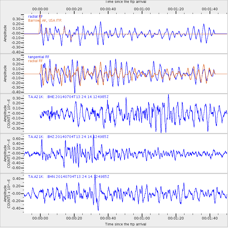
A21K Barrow, AK, USA - Earthquake Result Viewer
*The percent match for this event was below the threshold and hence no stack was calculated.
| Earthquake location: |
Solomon Islands |
| Earthquake latitude/longitude: |
-7.0/155.8 |
| Earthquake time(UTC): |
2014/07/04 (185) 13:12:18 GMT |
| Earthquake Depth: |
42 km |
| Earthquake Magnitude: |
5.6 MB, 5.4 MWB |
| Earthquake Catalog/Contributor: |
NEIC PDE/NEIC COMCAT |
|
| Network: |
TA USArray Transportable Network (new EarthScope stations) |
| Station: |
A21K Barrow, AK, USA |
| Lat/Lon: |
71.32 N/156.62 W |
| Elevation: |
577 m |
|
| Distance: |
84.2 deg |
| Az: |
13.821 deg |
| Baz: |
227.395 deg |
| Ray Param: |
$rayparam |
*The percent match for this event was below the threshold and hence was not used in the summary stack. |
|
| Radial Match: |
68.55269 % |
| Radial Bump: |
400 |
| Transverse Match: |
65.66501 % |
| Transverse Bump: |
400 |
| SOD ConfigId: |
751272 |
| Insert Time: |
2014-07-18 13:46:20.414 +0000 |
| GWidth: |
2.5 |
| Max Bumps: |
400 |
| Tol: |
0.001 |
|
Signal To Noise
| Channel | StoN | STA | LTA |
| TA:A21K: :BHZ:20140704T13:24:14.124985Z | 3.1834106 | 1.902774E-7 | 5.977155E-8 |
| TA:A21K: :BHN:20140704T13:24:14.124985Z | 1.5488886 | 9.63888E-8 | 6.223095E-8 |
| TA:A21K: :BHE:20140704T13:24:14.124985Z | 0.7149024 | 6.461903E-8 | 9.03886E-8 |
| Arrivals |
| Ps | |
| PpPs | |
| PsPs/PpSs | |


