You are here: Home > Network List > TA - USArray Transportable Network (new EarthScope stations) Stations List
> Station I23K Minto, Yukon-Koyukuk, AK, USA > Earthquake Result Viewer
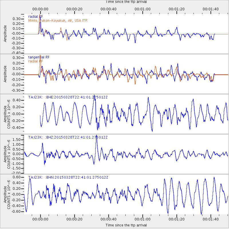
I23K Minto, Yukon-Koyukuk, AK, USA - Earthquake Result Viewer
*The percent match for this event was below the threshold and hence no stack was calculated.
| Earthquake location: |
Minahassa Peninsula, Sulawesi |
| Earthquake latitude/longitude: |
0.4/122.0 |
| Earthquake time(UTC): |
2015/03/28 (087) 22:28:51 GMT |
| Earthquake Depth: |
124 km |
| Earthquake Magnitude: |
5.8 MB |
| Earthquake Catalog/Contributor: |
NEIC PDE/NEIC ALERT |
|
| Network: |
TA USArray Transportable Network (new EarthScope stations) |
| Station: |
I23K Minto, Yukon-Koyukuk, AK, USA |
| Lat/Lon: |
65.15 N/149.36 W |
| Elevation: |
149 m |
|
| Distance: |
89.1 deg |
| Az: |
24.995 deg |
| Baz: |
268.934 deg |
| Ray Param: |
$rayparam |
*The percent match for this event was below the threshold and hence was not used in the summary stack. |
|
| Radial Match: |
59.775524 % |
| Radial Bump: |
341 |
| Transverse Match: |
55.82857 % |
| Transverse Bump: |
371 |
| SOD ConfigId: |
7422571 |
| Insert Time: |
2019-04-17 22:55:48.538 +0000 |
| GWidth: |
2.5 |
| Max Bumps: |
400 |
| Tol: |
0.001 |
|
Signal To Noise
| Channel | StoN | STA | LTA |
| TA:I23K: :BHZ:20150328T22:41:01.275012Z | 3.0667796 | 5.075536E-7 | 1.6550051E-7 |
| TA:I23K: :BHN:20150328T22:41:01.275012Z | 0.43639955 | 1.2214599E-7 | 2.7989486E-7 |
| TA:I23K: :BHE:20150328T22:41:01.275012Z | 1.4673895 | 3.0188488E-7 | 2.0572921E-7 |
| Arrivals |
| Ps | |
| PpPs | |
| PsPs/PpSs | |


