You are here: Home > Network List > IU - Global Seismograph Network (GSN - IRIS/USGS) Stations List
> Station JOHN Johnston Island, USA > Earthquake Result Viewer
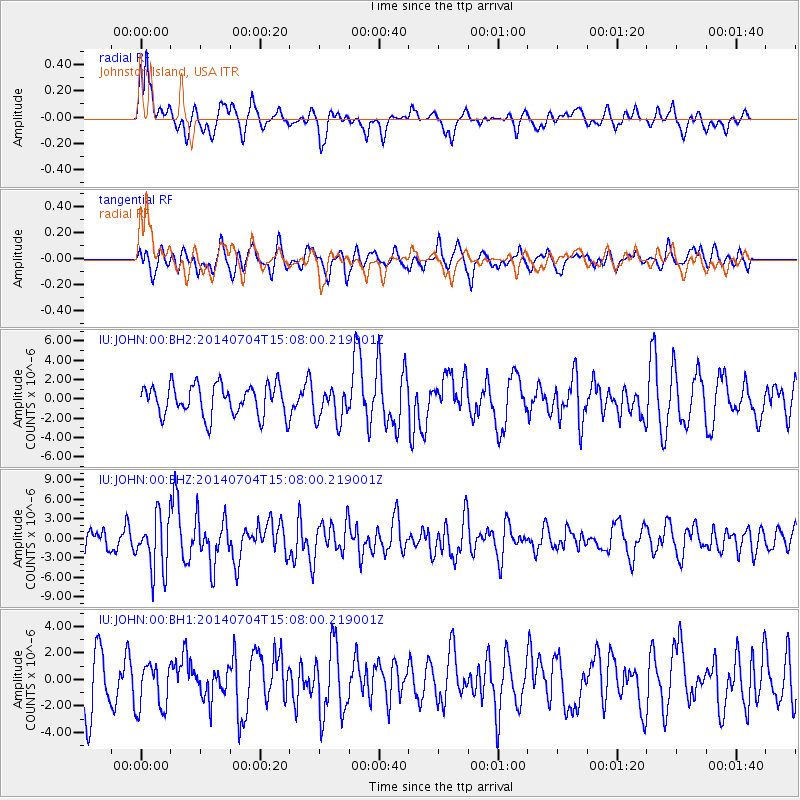
JOHN Johnston Island, USA - Earthquake Result Viewer
*The percent match for this event was below the threshold and hence no stack was calculated.
| Earthquake location: |
New Britain Region, P.N.G. |
| Earthquake latitude/longitude: |
-6.2/152.8 |
| Earthquake time(UTC): |
2014/07/04 (185) 15:00:26 GMT |
| Earthquake Depth: |
10 km |
| Earthquake Magnitude: |
6.6 MWP, 6.7 MI |
| Earthquake Catalog/Contributor: |
NEIC PDE/NEIC COMCAT |
|
| Network: |
IU Global Seismograph Network (GSN - IRIS/USGS) |
| Station: |
JOHN Johnston Island, USA |
| Lat/Lon: |
16.73 N/169.53 W |
| Elevation: |
2.0 m |
|
| Distance: |
43.7 deg |
| Az: |
57.985 deg |
| Baz: |
241.618 deg |
| Ray Param: |
$rayparam |
*The percent match for this event was below the threshold and hence was not used in the summary stack. |
|
| Radial Match: |
66.30583 % |
| Radial Bump: |
397 |
| Transverse Match: |
51.31027 % |
| Transverse Bump: |
400 |
| SOD ConfigId: |
751272 |
| Insert Time: |
2014-07-18 15:26:39.661 +0000 |
| GWidth: |
2.5 |
| Max Bumps: |
400 |
| Tol: |
0.001 |
|
Signal To Noise
| Channel | StoN | STA | LTA |
| IU:JOHN:00:BHZ:20140704T15:08:00.219001Z | 2.986589 | 4.2358874E-6 | 1.4183029E-6 |
| IU:JOHN:00:BH1:20140704T15:08:00.219001Z | 0.9486656 | 1.7907167E-6 | 1.8876163E-6 |
| IU:JOHN:00:BH2:20140704T15:08:00.219001Z | 1.1084057 | 1.7856529E-6 | 1.6110101E-6 |
| Arrivals |
| Ps | |
| PpPs | |
| PsPs/PpSs | |


