You are here: Home > Network List > TA - USArray Transportable Network (new EarthScope stations) Stations List
> Station Y12C Blythe, CA, USA > Earthquake Result Viewer
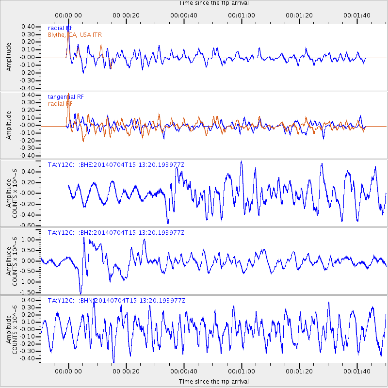
Y12C Blythe, CA, USA - Earthquake Result Viewer
*The percent match for this event was below the threshold and hence no stack was calculated.
| Earthquake location: |
New Britain Region, P.N.G. |
| Earthquake latitude/longitude: |
-6.2/152.8 |
| Earthquake time(UTC): |
2014/07/04 (185) 15:00:26 GMT |
| Earthquake Depth: |
10 km |
| Earthquake Magnitude: |
6.6 MWP, 6.7 MI |
| Earthquake Catalog/Contributor: |
NEIC PDE/NEIC COMCAT |
|
| Network: |
TA USArray Transportable Network (new EarthScope stations) |
| Station: |
Y12C Blythe, CA, USA |
| Lat/Lon: |
33.75 N/114.52 W |
| Elevation: |
196 m |
|
| Distance: |
95.6 deg |
| Az: |
56.751 deg |
| Baz: |
266.314 deg |
| Ray Param: |
$rayparam |
*The percent match for this event was below the threshold and hence was not used in the summary stack. |
|
| Radial Match: |
71.57427 % |
| Radial Bump: |
400 |
| Transverse Match: |
62.082233 % |
| Transverse Bump: |
400 |
| SOD ConfigId: |
751272 |
| Insert Time: |
2014-07-18 15:36:31.352 +0000 |
| GWidth: |
2.5 |
| Max Bumps: |
400 |
| Tol: |
0.001 |
|
Signal To Noise
| Channel | StoN | STA | LTA |
| TA:Y12C: :BHZ:20140704T15:13:20.193977Z | 5.084912 | 6.067314E-7 | 1.1931996E-7 |
| TA:Y12C: :BHN:20140704T15:13:20.193977Z | 1.32422 | 1.3766379E-7 | 1.039584E-7 |
| TA:Y12C: :BHE:20140704T15:13:20.193977Z | 1.6998017 | 2.0629574E-7 | 1.213646E-7 |
| Arrivals |
| Ps | |
| PpPs | |
| PsPs/PpSs | |


