You are here: Home > Network List > US - United States National Seismic Network Stations List
> Station MSO Missoula, Montana, USA > Earthquake Result Viewer
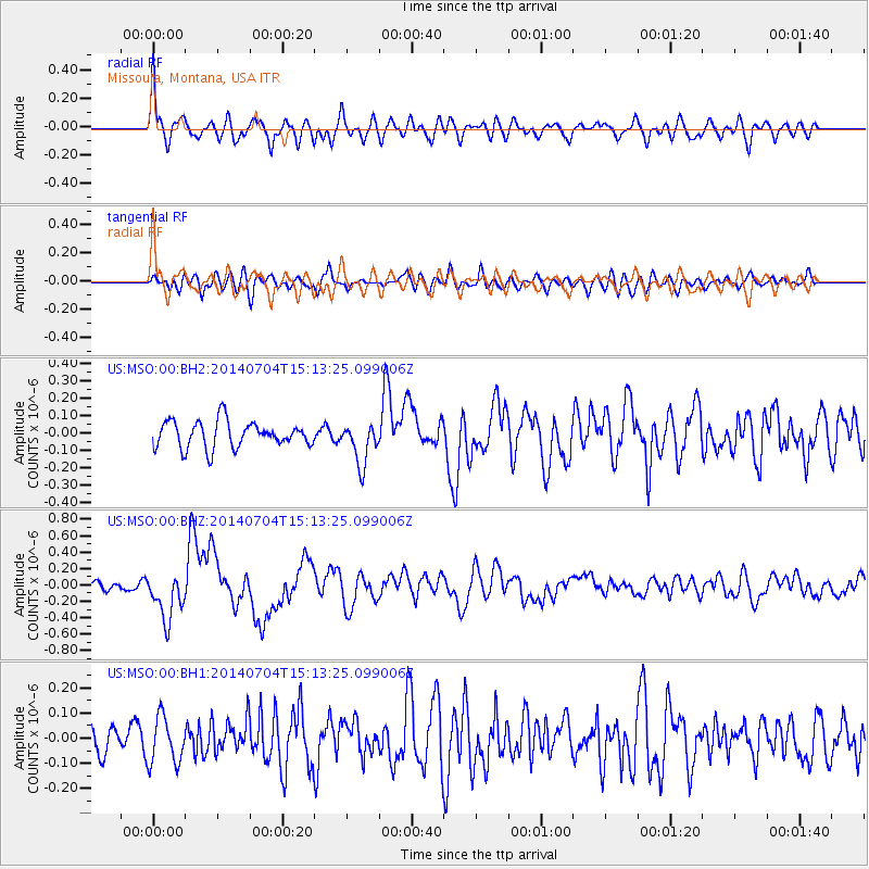
MSO Missoula, Montana, USA - Earthquake Result Viewer
*The percent match for this event was below the threshold and hence no stack was calculated.
| Earthquake location: |
New Britain Region, P.N.G. |
| Earthquake latitude/longitude: |
-6.2/152.8 |
| Earthquake time(UTC): |
2014/07/04 (185) 15:00:26 GMT |
| Earthquake Depth: |
10 km |
| Earthquake Magnitude: |
6.6 MWP, 6.7 MI |
| Earthquake Catalog/Contributor: |
NEIC PDE/NEIC COMCAT |
|
| Network: |
US United States National Seismic Network |
| Station: |
MSO Missoula, Montana, USA |
| Lat/Lon: |
46.83 N/113.94 W |
| Elevation: |
1264 m |
|
| Distance: |
96.7 deg |
| Az: |
43.648 deg |
| Baz: |
268.102 deg |
| Ray Param: |
$rayparam |
*The percent match for this event was below the threshold and hence was not used in the summary stack. |
|
| Radial Match: |
77.34266 % |
| Radial Bump: |
400 |
| Transverse Match: |
46.0501 % |
| Transverse Bump: |
400 |
| SOD ConfigId: |
751272 |
| Insert Time: |
2014-07-18 15:38:05.399 +0000 |
| GWidth: |
2.5 |
| Max Bumps: |
400 |
| Tol: |
0.001 |
|
Signal To Noise
| Channel | StoN | STA | LTA |
| US:MSO:00:BHZ:20140704T15:13:25.099006Z | 3.796471 | 2.922531E-7 | 7.69802E-8 |
| US:MSO:00:BH1:20140704T15:13:25.099006Z | 1.3493944 | 9.277324E-8 | 6.875176E-8 |
| US:MSO:00:BH2:20140704T15:13:25.099006Z | 1.5969584 | 1.2047282E-7 | 7.543892E-8 |
| Arrivals |
| Ps | |
| PpPs | |
| PsPs/PpSs | |


