You are here: Home > Network List > GS - US Geological Survey Networks Stations List
> Station KAN10 Keim Farm > Earthquake Result Viewer
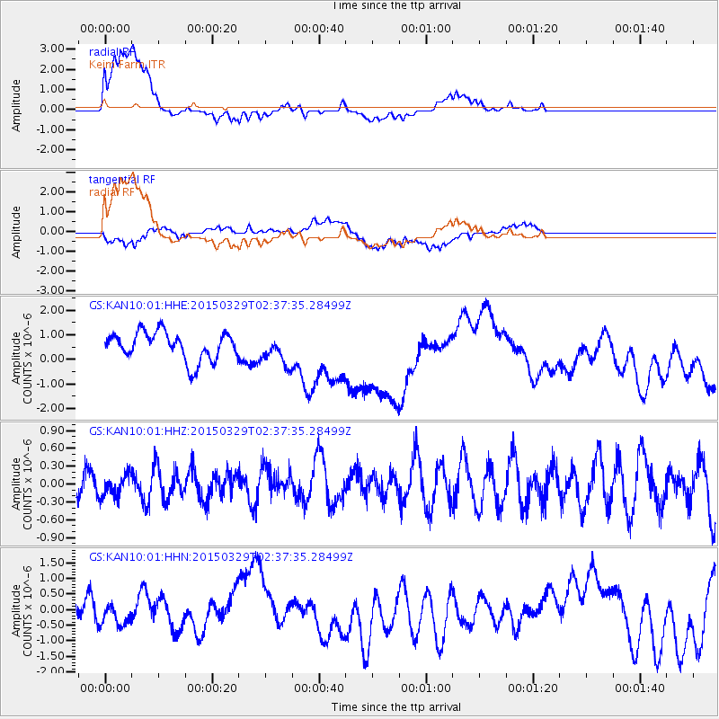
KAN10 Keim Farm - Earthquake Result Viewer
*The percent match for this event was below the threshold and hence no stack was calculated.
| Earthquake location: |
Hokkaido, Japan Region |
| Earthquake latitude/longitude: |
43.0/142.1 |
| Earthquake time(UTC): |
2015/03/29 (088) 02:25:56 GMT |
| Earthquake Depth: |
150 km |
| Earthquake Magnitude: |
4.0 mb, 4.0 mb |
| Earthquake Catalog/Contributor: |
ISC/ISC |
|
| Network: |
GS US Geological Survey Networks |
| Station: |
KAN10 Keim Farm |
| Lat/Lon: |
37.12 N/98.10 W |
| Elevation: |
417 m |
|
| Distance: |
83.3 deg |
| Az: |
44.298 deg |
| Baz: |
320.16 deg |
| Ray Param: |
$rayparam |
*The percent match for this event was below the threshold and hence was not used in the summary stack. |
|
| Radial Match: |
47.360218 % |
| Radial Bump: |
400 |
| Transverse Match: |
35.343506 % |
| Transverse Bump: |
400 |
| SOD ConfigId: |
7422571 |
| Insert Time: |
2019-04-17 23:01:28.684 +0000 |
| GWidth: |
2.5 |
| Max Bumps: |
400 |
| Tol: |
0.001 |
|
Signal To Noise
| Channel | StoN | STA | LTA |
| GS:KAN10:01:HHZ:20150329T02:37:35.28499Z | 0.61371046 | 1.9086761E-7 | 3.1100598E-7 |
| GS:KAN10:01:HHN:20150329T02:37:35.28499Z | 0.40219104 | 2.9124507E-7 | 7.2414605E-7 |
| GS:KAN10:01:HHE:20150329T02:37:35.28499Z | 1.0301733 | 5.8835076E-7 | 5.711183E-7 |
| Arrivals |
| Ps | |
| PpPs | |
| PsPs/PpSs | |


