You are here: Home > Network List > IU - Global Seismograph Network (GSN - IRIS/USGS) Stations List
> Station FURI Mt. Furi, Ethiopia > Earthquake Result Viewer
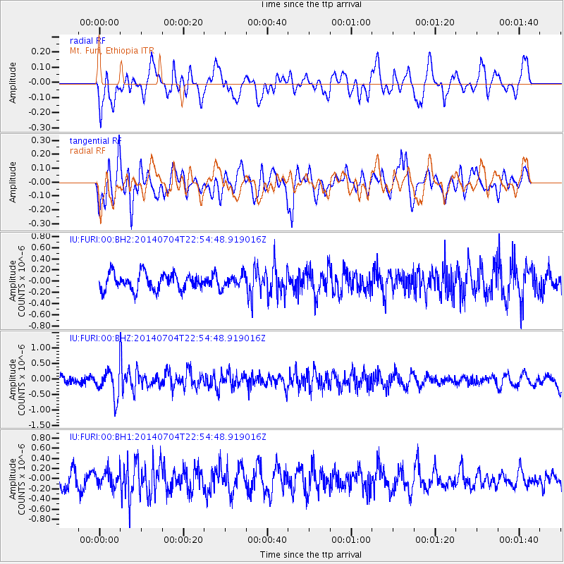
FURI Mt. Furi, Ethiopia - Earthquake Result Viewer
*The percent match for this event was below the threshold and hence no stack was calculated.
| Earthquake location: |
Near East Coast Of Honshu, Japan |
| Earthquake latitude/longitude: |
39.7/142.0 |
| Earthquake time(UTC): |
2014/07/04 (185) 22:42:04 GMT |
| Earthquake Depth: |
45 km |
| Earthquake Magnitude: |
5.7 MB |
| Earthquake Catalog/Contributor: |
NEIC PDE/NEIC COMCAT |
|
| Network: |
IU Global Seismograph Network (GSN - IRIS/USGS) |
| Station: |
FURI Mt. Furi, Ethiopia |
| Lat/Lon: |
8.90 N/38.68 E |
| Elevation: |
2570 m |
|
| Distance: |
94.5 deg |
| Az: |
285.337 deg |
| Baz: |
48.871 deg |
| Ray Param: |
$rayparam |
*The percent match for this event was below the threshold and hence was not used in the summary stack. |
|
| Radial Match: |
64.89952 % |
| Radial Bump: |
400 |
| Transverse Match: |
49.01166 % |
| Transverse Bump: |
400 |
| SOD ConfigId: |
751272 |
| Insert Time: |
2014-07-18 23:22:28.941 +0000 |
| GWidth: |
2.5 |
| Max Bumps: |
400 |
| Tol: |
0.001 |
|
Signal To Noise
| Channel | StoN | STA | LTA |
| IU:FURI:00:BHZ:20140704T22:54:48.919016Z | 4.305696 | 4.6597108E-7 | 1.0822202E-7 |
| IU:FURI:00:BH1:20140704T22:54:48.919016Z | 1.1834399 | 1.579981E-7 | 1.3350751E-7 |
| IU:FURI:00:BH2:20140704T22:54:48.919016Z | 0.7588906 | 1.1222715E-7 | 1.4788317E-7 |
| Arrivals |
| Ps | |
| PpPs | |
| PsPs/PpSs | |


