You are here: Home > Network List > TA - USArray Transportable Network (new EarthScope stations) Stations List
> Station A21K Barrow, AK, USA > Earthquake Result Viewer
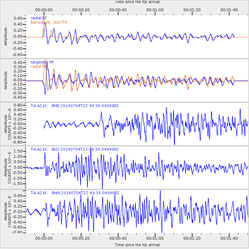
A21K Barrow, AK, USA - Earthquake Result Viewer
*The percent match for this event was below the threshold and hence no stack was calculated.
| Earthquake location: |
Near East Coast Of Honshu, Japan |
| Earthquake latitude/longitude: |
39.7/142.0 |
| Earthquake time(UTC): |
2014/07/04 (185) 22:42:04 GMT |
| Earthquake Depth: |
45 km |
| Earthquake Magnitude: |
5.7 MB |
| Earthquake Catalog/Contributor: |
NEIC PDE/NEIC COMCAT |
|
| Network: |
TA USArray Transportable Network (new EarthScope stations) |
| Station: |
A21K Barrow, AK, USA |
| Lat/Lon: |
71.32 N/156.62 W |
| Elevation: |
577 m |
|
| Distance: |
43.8 deg |
| Az: |
24.088 deg |
| Baz: |
257.879 deg |
| Ray Param: |
$rayparam |
*The percent match for this event was below the threshold and hence was not used in the summary stack. |
|
| Radial Match: |
74.95416 % |
| Radial Bump: |
400 |
| Transverse Match: |
72.27705 % |
| Transverse Bump: |
400 |
| SOD ConfigId: |
751272 |
| Insert Time: |
2014-07-18 23:42:42.616 +0000 |
| GWidth: |
2.5 |
| Max Bumps: |
400 |
| Tol: |
0.001 |
|
Signal To Noise
| Channel | StoN | STA | LTA |
| TA:A21K: :BHZ:20140704T22:49:36.049998Z | 9.249137 | 4.6755812E-7 | 5.055154E-8 |
| TA:A21K: :BHN:20140704T22:49:36.049998Z | 3.41216 | 2.0975233E-7 | 6.147201E-8 |
| TA:A21K: :BHE:20140704T22:49:36.049998Z | 3.4500895 | 2.4001557E-7 | 6.9567925E-8 |
| Arrivals |
| Ps | |
| PpPs | |
| PsPs/PpSs | |


