You are here: Home > Network List > TA - USArray Transportable Network (new EarthScope stations) Stations List
> Station R11A Troy Canyon, Currant, NV, USA > Earthquake Result Viewer
R11A Troy Canyon, Currant, NV, USA - Earthquake Result Viewer
*The percent match for this event was below the threshold and hence no stack was calculated.
| Earthquake location: |
Rat Islands, Aleutian Islands |
| Earthquake latitude/longitude: |
51.8/178.5 |
| Earthquake time(UTC): |
2014/06/23 (174) 21:00:01 GMT |
| Earthquake Depth: |
106 km |
| Earthquake Magnitude: |
5.7 MB, 5.2 ML |
| Earthquake Catalog/Contributor: |
NEIC PDE/NEIC COMCAT |
|
| Network: |
TA USArray Transportable Network (new EarthScope stations) |
| Station: |
R11A Troy Canyon, Currant, NV, USA |
| Lat/Lon: |
38.35 N/115.59 W |
| Elevation: |
1756 m |
|
| Distance: |
46.9 deg |
| Az: |
79.573 deg |
| Baz: |
309.076 deg |
| Ray Param: |
$rayparam |
*The percent match for this event was below the threshold and hence was not used in the summary stack. |
|
| Radial Match: |
43.254097 % |
| Radial Bump: |
302 |
| Transverse Match: |
53.299408 % |
| Transverse Bump: |
331 |
| SOD ConfigId: |
751272 |
| Insert Time: |
2014-07-20 04:56:06.707 +0000 |
| GWidth: |
2.5 |
| Max Bumps: |
400 |
| Tol: |
0.001 |
|
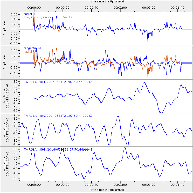
Signal To Noise
| Channel | StoN | STA | LTA |
| TA:R11A: :BHZ:20140623T21:07:50.449994Z | 0.89681375 | 1.80157E-5 | 2.0088564E-5 |
| TA:R11A: :BHN:20140623T21:07:50.449994Z | 4.61222 | 3.770363E-5 | 8.174726E-6 |
| TA:R11A: :BHE:20140623T21:07:50.449994Z | 2.184657 | 1.8704943E-5 | 8.561958E-6 |
| Arrivals |
| Ps | |
| PpPs | |
| PsPs/PpSs | |


