You are here: Home > Network List > WY - Yellowstone Wyoming Seismic Network Stations List
> Station YHH Holmes Hill, YNP, WY, USA > Earthquake Result Viewer
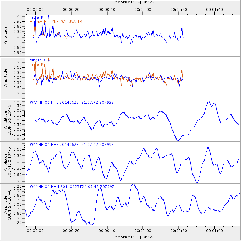
YHH Holmes Hill, YNP, WY, USA - Earthquake Result Viewer
*The percent match for this event was below the threshold and hence no stack was calculated.
| Earthquake location: |
Rat Islands, Aleutian Islands |
| Earthquake latitude/longitude: |
51.8/178.5 |
| Earthquake time(UTC): |
2014/06/23 (174) 21:00:01 GMT |
| Earthquake Depth: |
106 km |
| Earthquake Magnitude: |
5.7 MB, 5.2 ML |
| Earthquake Catalog/Contributor: |
NEIC PDE/NEIC COMCAT |
|
| Network: |
WY Yellowstone Wyoming Seismic Network |
| Station: |
YHH Holmes Hill, YNP, WY, USA |
| Lat/Lon: |
44.79 N/110.85 W |
| Elevation: |
2717 m |
|
| Distance: |
45.8 deg |
| Az: |
69.52 deg |
| Baz: |
305.264 deg |
| Ray Param: |
$rayparam |
*The percent match for this event was below the threshold and hence was not used in the summary stack. |
|
| Radial Match: |
74.02105 % |
| Radial Bump: |
400 |
| Transverse Match: |
66.65897 % |
| Transverse Bump: |
333 |
| SOD ConfigId: |
751272 |
| Insert Time: |
2014-07-20 05:03:25.746 +0000 |
| GWidth: |
2.5 |
| Max Bumps: |
400 |
| Tol: |
0.001 |
|
Signal To Noise
| Channel | StoN | STA | LTA |
| WY:YHH:01:HHZ:20140623T21:07:42.20799Z | 1.0985248 | 3.4637398E-7 | 3.1530828E-7 |
| WY:YHH:01:HHN:20140623T21:07:42.20799Z | 0.7960313 | 2.908359E-7 | 3.6535735E-7 |
| WY:YHH:01:HHE:20140623T21:07:42.20799Z | 2.503356 | 6.411513E-7 | 2.561167E-7 |
| Arrivals |
| Ps | |
| PpPs | |
| PsPs/PpSs | |


