You are here: Home > Network List > TA - USArray Transportable Network (new EarthScope stations) Stations List
> Station E52A Mattawa, ON, CAN > Earthquake Result Viewer
E52A Mattawa, ON, CAN - Earthquake Result Viewer

| Earthquake location: |
Near Coast Of Chiapas, Mexico |
| Earthquake latitude/longitude: |
14.7/-92.4 |
| Earthquake time(UTC): |
2014/07/07 (188) 11:23:55 GMT |
| Earthquake Depth: |
60 km |
| Earthquake Magnitude: |
6.9 MWW, 6.9 MWC, 7.1 MI |
| Earthquake Catalog/Contributor: |
NEIC PDE/NEIC COMCAT |
|
| Network: |
TA USArray Transportable Network (new EarthScope stations) |
| Station: |
E52A Mattawa, ON, CAN |
| Lat/Lon: |
46.29 N/78.66 W |
| Elevation: |
252 m |
|
| Distance: |
33.5 deg |
| Az: |
17.38 deg |
| Baz: |
204.628 deg |
| Ray Param: |
0.07803666 |
| Estimated Moho Depth: |
32.5 km |
| Estimated Crust Vp/Vs: |
2.02 |
| Assumed Crust Vp: |
6.622 km/s |
| Estimated Crust Vs: |
3.278 km/s |
| Estimated Crust Poisson's Ratio: |
0.34 |
|
| Radial Match: |
94.98589 % |
| Radial Bump: |
286 |
| Transverse Match: |
79.230064 % |
| Transverse Bump: |
400 |
| SOD ConfigId: |
751272 |
| Insert Time: |
2014-07-21 12:09:05.265 +0000 |
| GWidth: |
2.5 |
| Max Bumps: |
400 |
| Tol: |
0.001 |
|
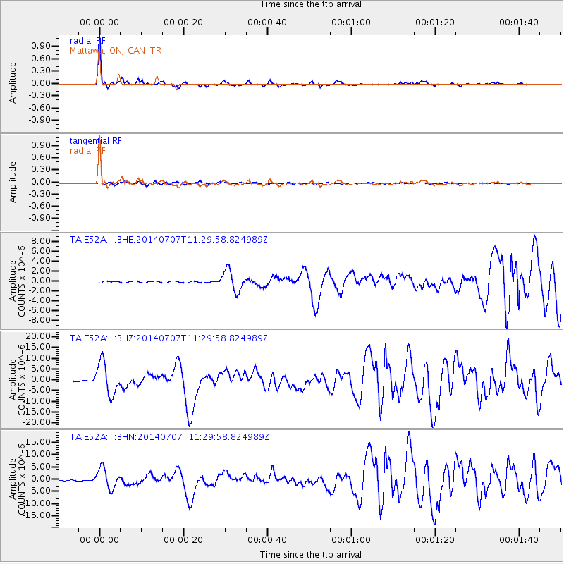
Signal To Noise
| Channel | StoN | STA | LTA |
| TA:E52A: :BHZ:20140707T11:29:58.824989Z | 41.80618 | 7.588093E-6 | 1.8150651E-7 |
| TA:E52A: :BHN:20140707T11:29:58.824989Z | 39.41846 | 4.1620824E-6 | 1.05587134E-7 |
| TA:E52A: :BHE:20140707T11:29:58.824989Z | 15.1728115 | 2.1362957E-6 | 1.4079761E-7 |
| Arrivals |
| Ps | 5.4 SECOND |
| PpPs | 14 SECOND |
| PsPs/PpSs | 19 SECOND |


