You are here: Home > Network List > TA - USArray Transportable Network (new EarthScope stations) Stations List
> Station J04D Umpqua National Forest, Toketee, OR, USA > Earthquake Result Viewer
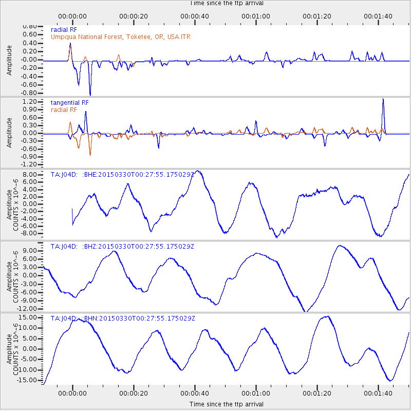
J04D Umpqua National Forest, Toketee, OR, USA - Earthquake Result Viewer
*The percent match for this event was below the threshold and hence no stack was calculated.
| Earthquake location: |
New Britain Region, P.N.G. |
| Earthquake latitude/longitude: |
-5.2/152.6 |
| Earthquake time(UTC): |
2015/03/30 (089) 00:15:30 GMT |
| Earthquake Depth: |
35 km |
| Earthquake Magnitude: |
5.7 MB |
| Earthquake Catalog/Contributor: |
NEIC PDE/NEIC COMCAT |
|
| Network: |
TA USArray Transportable Network (new EarthScope stations) |
| Station: |
J04D Umpqua National Forest, Toketee, OR, USA |
| Lat/Lon: |
43.24 N/122.11 W |
| Elevation: |
1948 m |
|
| Distance: |
90.1 deg |
| Az: |
46.744 deg |
| Baz: |
263.026 deg |
| Ray Param: |
$rayparam |
*The percent match for this event was below the threshold and hence was not used in the summary stack. |
|
| Radial Match: |
80.030014 % |
| Radial Bump: |
352 |
| Transverse Match: |
57.901676 % |
| Transverse Bump: |
293 |
| SOD ConfigId: |
7422571 |
| Insert Time: |
2019-04-17 23:23:20.768 +0000 |
| GWidth: |
2.5 |
| Max Bumps: |
400 |
| Tol: |
0.001 |
|
Signal To Noise
| Channel | StoN | STA | LTA |
| TA:J04D: :BHZ:20150330T00:27:55.175029Z | 2.8273177 | 6.6319953E-6 | 2.3456846E-6 |
| TA:J04D: :BHN:20150330T00:27:55.175029Z | 1.0215585 | 1.5809648E-5 | 1.5476007E-5 |
| TA:J04D: :BHE:20150330T00:27:55.175029Z | 0.8247758 | 2.181131E-6 | 2.644514E-6 |
| Arrivals |
| Ps | |
| PpPs | |
| PsPs/PpSs | |


