You are here: Home > Network List > TA - USArray Transportable Network (new EarthScope stations) Stations List
> Station P56A Dayton Farm, Ripley, WV, USA > Earthquake Result Viewer
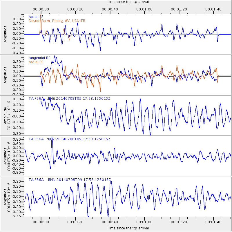
P56A Dayton Farm, Ripley, WV, USA - Earthquake Result Viewer
*The percent match for this event was below the threshold and hence no stack was calculated.
| Earthquake location: |
Hokkaido, Japan Region |
| Earthquake latitude/longitude: |
42.7/141.4 |
| Earthquake time(UTC): |
2014/07/08 (189) 09:05:23 GMT |
| Earthquake Depth: |
10 km |
| Earthquake Magnitude: |
5.6 MB, 5.5 MWB |
| Earthquake Catalog/Contributor: |
NEIC PDE/NEIC COMCAT |
|
| Network: |
TA USArray Transportable Network (new EarthScope stations) |
| Station: |
P56A Dayton Farm, Ripley, WV, USA |
| Lat/Lon: |
39.50 N/78.84 W |
| Elevation: |
249 m |
|
| Distance: |
90.4 deg |
| Az: |
29.993 deg |
| Baz: |
331.545 deg |
| Ray Param: |
$rayparam |
*The percent match for this event was below the threshold and hence was not used in the summary stack. |
|
| Radial Match: |
64.07214 % |
| Radial Bump: |
362 |
| Transverse Match: |
45.28116 % |
| Transverse Bump: |
400 |
| SOD ConfigId: |
751272 |
| Insert Time: |
2014-07-22 09:40:41.679 +0000 |
| GWidth: |
2.5 |
| Max Bumps: |
400 |
| Tol: |
0.001 |
|
Signal To Noise
| Channel | StoN | STA | LTA |
| TA:P56A: :BHZ:20140708T09:17:53.125015Z | 0.71084946 | 1.0877535E-7 | 1.5302165E-7 |
| TA:P56A: :BHN:20140708T09:17:53.125015Z | 0.7328601 | 9.723238E-8 | 1.3267524E-7 |
| TA:P56A: :BHE:20140708T09:17:53.125015Z | 1.0320759 | 1.54825E-7 | 1.500132E-7 |
| Arrivals |
| Ps | |
| PpPs | |
| PsPs/PpSs | |


