You are here: Home > Network List > IU - Global Seismograph Network (GSN - IRIS/USGS) Stations List
> Station PMG Port Moresby, New Guinea > Earthquake Result Viewer
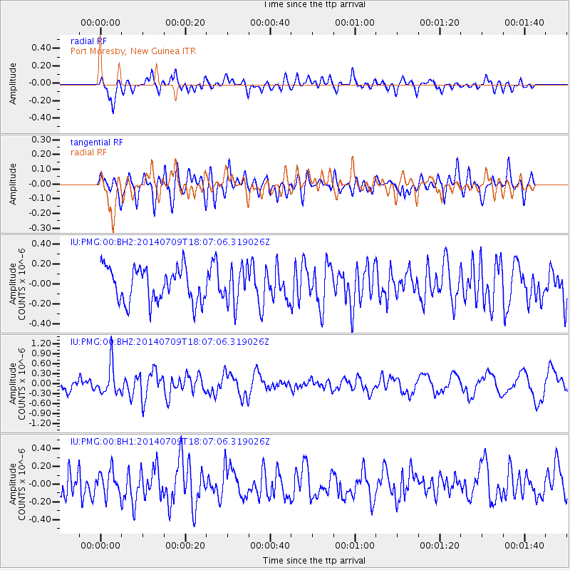
PMG Port Moresby, New Guinea - Earthquake Result Viewer
*The percent match for this event was below the threshold and hence no stack was calculated.
| Earthquake location: |
Balleny Islands Region |
| Earthquake latitude/longitude: |
-62.1/164.9 |
| Earthquake time(UTC): |
2014/07/09 (190) 17:58:11 GMT |
| Earthquake Depth: |
10 km |
| Earthquake Magnitude: |
5.5 MB |
| Earthquake Catalog/Contributor: |
NEIC PDE/NEIC COMCAT |
|
| Network: |
IU Global Seismograph Network (GSN - IRIS/USGS) |
| Station: |
PMG Port Moresby, New Guinea |
| Lat/Lon: |
9.40 S/147.16 E |
| Elevation: |
90 m |
|
| Distance: |
54.2 deg |
| Az: |
338.237 deg |
| Baz: |
169.822 deg |
| Ray Param: |
$rayparam |
*The percent match for this event was below the threshold and hence was not used in the summary stack. |
|
| Radial Match: |
72.01331 % |
| Radial Bump: |
400 |
| Transverse Match: |
61.38482 % |
| Transverse Bump: |
400 |
| SOD ConfigId: |
751272 |
| Insert Time: |
2014-07-23 18:20:13.562 +0000 |
| GWidth: |
2.5 |
| Max Bumps: |
400 |
| Tol: |
0.001 |
|
Signal To Noise
| Channel | StoN | STA | LTA |
| IU:PMG:00:BHZ:20140709T18:07:06.319026Z | 2.3023462 | 4.571274E-7 | 1.985485E-7 |
| IU:PMG:00:BH1:20140709T18:07:06.319026Z | 0.9287226 | 1.4023607E-7 | 1.5099887E-7 |
| IU:PMG:00:BH2:20140709T18:07:06.319026Z | 1.083246 | 1.8385559E-7 | 1.6972655E-7 |
| Arrivals |
| Ps | |
| PpPs | |
| PsPs/PpSs | |


