You are here: Home > Network List > AZ - ANZA Regional Network Stations List
> Station SMER AZ.SMER > Earthquake Result Viewer
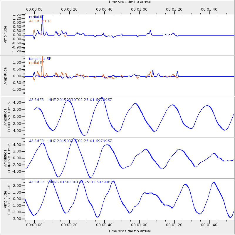
SMER AZ.SMER - Earthquake Result Viewer
*The percent match for this event was below the threshold and hence no stack was calculated.
| Earthquake location: |
Southeast Of Loyalty Islands |
| Earthquake latitude/longitude: |
-22.5/170.8 |
| Earthquake time(UTC): |
2015/03/30 (089) 02:12:45 GMT |
| Earthquake Depth: |
42 km |
| Earthquake Magnitude: |
5.0 mb, 5.0 mb |
| Earthquake Catalog/Contributor: |
ISC/ISC |
|
| Network: |
AZ ANZA Regional Network |
| Station: |
SMER AZ.SMER |
| Lat/Lon: |
33.46 N/117.17 W |
| Elevation: |
355 m |
|
| Distance: |
88.3 deg |
| Az: |
52.709 deg |
| Baz: |
241.614 deg |
| Ray Param: |
$rayparam |
*The percent match for this event was below the threshold and hence was not used in the summary stack. |
|
| Radial Match: |
85.664314 % |
| Radial Bump: |
400 |
| Transverse Match: |
83.487915 % |
| Transverse Bump: |
400 |
| SOD ConfigId: |
7422571 |
| Insert Time: |
2019-04-17 23:41:49.566 +0000 |
| GWidth: |
2.5 |
| Max Bumps: |
400 |
| Tol: |
0.001 |
|
Signal To Noise
| Channel | StoN | STA | LTA |
| AZ:SMER: :HHZ:20150330T02:25:01.697996Z | 2.201516 | 3.2764335E-6 | 1.4882625E-6 |
| AZ:SMER: :HHN:20150330T02:25:01.697996Z | 1.9552438 | 2.1610558E-6 | 1.1052615E-6 |
| AZ:SMER: :HHE:20150330T02:25:01.697996Z | 1.3281201 | 3.5928756E-6 | 2.705234E-6 |
| Arrivals |
| Ps | |
| PpPs | |
| PsPs/PpSs | |


