You are here: Home > Network List > CI - Caltech Regional Seismic Network Stations List
> Station LRL Laurel Mtn Radio Fac, Ridgecrest, CA, USA > Earthquake Result Viewer
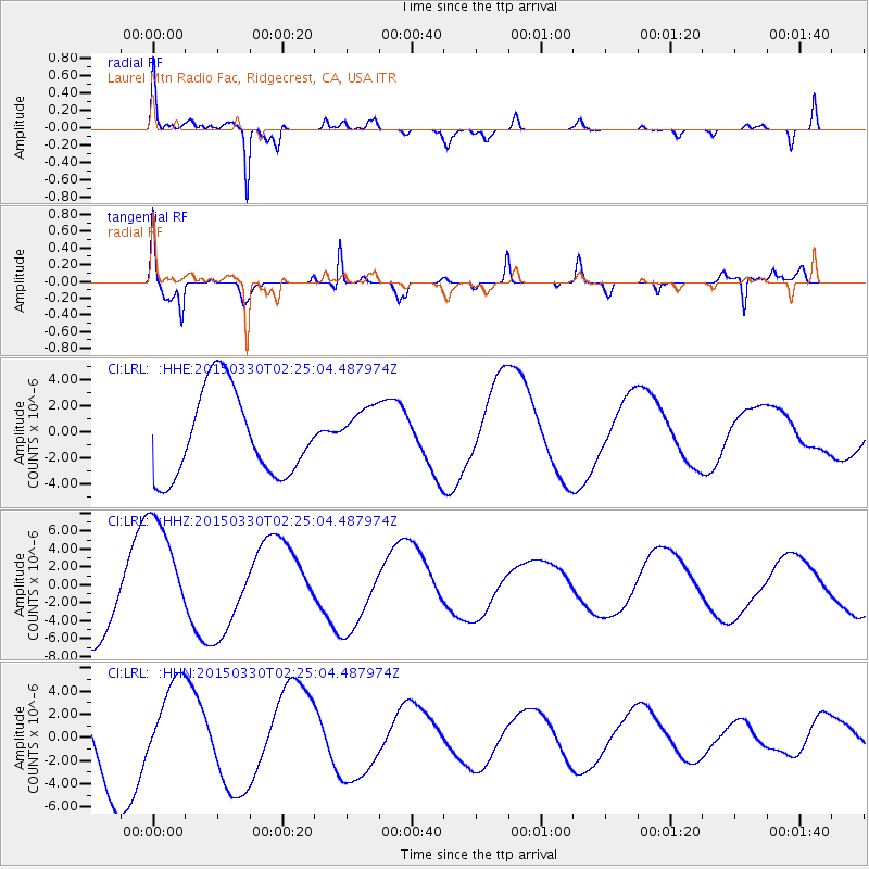
LRL Laurel Mtn Radio Fac, Ridgecrest, CA, USA - Earthquake Result Viewer
*The percent match for this event was below the threshold and hence no stack was calculated.
| Earthquake location: |
Southeast Of Loyalty Islands |
| Earthquake latitude/longitude: |
-22.5/170.8 |
| Earthquake time(UTC): |
2015/03/30 (089) 02:12:45 GMT |
| Earthquake Depth: |
42 km |
| Earthquake Magnitude: |
5.0 mb, 5.0 mb |
| Earthquake Catalog/Contributor: |
ISC/ISC |
|
| Network: |
CI Caltech Regional Seismic Network |
| Station: |
LRL Laurel Mtn Radio Fac, Ridgecrest, CA, USA |
| Lat/Lon: |
35.48 N/117.68 W |
| Elevation: |
1340 m |
|
| Distance: |
88.9 deg |
| Az: |
50.735 deg |
| Baz: |
241.278 deg |
| Ray Param: |
$rayparam |
*The percent match for this event was below the threshold and hence was not used in the summary stack. |
|
| Radial Match: |
89.32332 % |
| Radial Bump: |
400 |
| Transverse Match: |
82.69299 % |
| Transverse Bump: |
400 |
| SOD ConfigId: |
7422571 |
| Insert Time: |
2019-04-17 23:42:27.384 +0000 |
| GWidth: |
2.5 |
| Max Bumps: |
400 |
| Tol: |
0.001 |
|
Signal To Noise
| Channel | StoN | STA | LTA |
| CI:LRL: :HHZ:20150330T02:25:04.487974Z | 1.7793499 | 6.612451E-6 | 3.7162172E-6 |
| CI:LRL: :HHN:20150330T02:25:04.487974Z | 1.0337368 | 3.8381586E-6 | 3.712897E-6 |
| CI:LRL: :HHE:20150330T02:25:04.487974Z | 0.61878514 | 2.034427E-6 | 3.287776E-6 |
| Arrivals |
| Ps | |
| PpPs | |
| PsPs/PpSs | |


