You are here: Home > Network List > AV - Alaska Volcano Observatory Stations List
> Station MAPS Pakushin Southeast, Makushin Volcano, Alaska > Earthquake Result Viewer
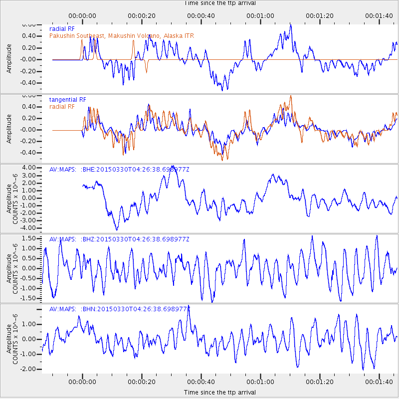
MAPS Pakushin Southeast, Makushin Volcano, Alaska - Earthquake Result Viewer
*The percent match for this event was below the threshold and hence no stack was calculated.
| Earthquake location: |
New Britain Region, P.N.G. |
| Earthquake latitude/longitude: |
-5.4/152.5 |
| Earthquake time(UTC): |
2015/03/30 (089) 04:16:14 GMT |
| Earthquake Depth: |
41 km |
| Earthquake Magnitude: |
5.3 mb, 5.2 mb, 4.7 MS |
| Earthquake Catalog/Contributor: |
ISC/ISC |
|
| Network: |
AV Alaska Volcano Observatory |
| Station: |
MAPS Pakushin Southeast, Makushin Volcano, Alaska |
| Lat/Lon: |
53.81 N/166.94 W |
| Elevation: |
333 m |
|
| Distance: |
68.0 deg |
| Az: |
24.551 deg |
| Baz: |
224.23 deg |
| Ray Param: |
$rayparam |
*The percent match for this event was below the threshold and hence was not used in the summary stack. |
|
| Radial Match: |
47.728966 % |
| Radial Bump: |
400 |
| Transverse Match: |
51.024727 % |
| Transverse Bump: |
400 |
| SOD ConfigId: |
7422571 |
| Insert Time: |
2019-04-17 23:45:54.595 +0000 |
| GWidth: |
2.5 |
| Max Bumps: |
400 |
| Tol: |
0.001 |
|
Signal To Noise
| Channel | StoN | STA | LTA |
| AV:MAPS: :BHZ:20150330T04:26:38.698977Z | 0.7458051 | 5.027518E-7 | 6.741061E-7 |
| AV:MAPS: :BHN:20150330T04:26:38.698977Z | 1.2158571 | 9.818032E-7 | 8.074988E-7 |
| AV:MAPS: :BHE:20150330T04:26:38.698977Z | 2.0197775 | 3.5536627E-6 | 1.7594327E-6 |
| Arrivals |
| Ps | |
| PpPs | |
| PsPs/PpSs | |


