You are here: Home > Network List > TA - USArray Transportable Network (new EarthScope stations) Stations List
> Station A21K Barrow, AK, USA > Earthquake Result Viewer
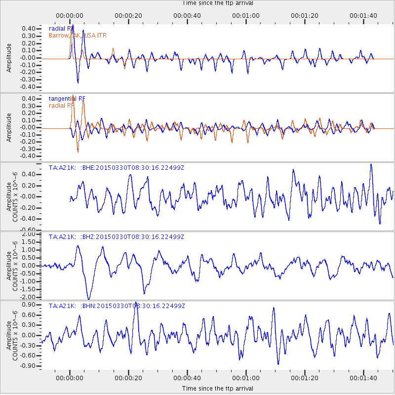
A21K Barrow, AK, USA - Earthquake Result Viewer
*The percent match for this event was below the threshold and hence no stack was calculated.
| Earthquake location: |
Samoa Islands Region |
| Earthquake latitude/longitude: |
-15.4/-172.9 |
| Earthquake time(UTC): |
2015/03/30 (089) 08:18:00 GMT |
| Earthquake Depth: |
10 km |
| Earthquake Magnitude: |
6.8 MWP, 6.8 MI |
| Earthquake Catalog/Contributor: |
NEIC PDE/NEIC COMCAT |
|
| Network: |
TA USArray Transportable Network (new EarthScope stations) |
| Station: |
A21K Barrow, AK, USA |
| Lat/Lon: |
71.32 N/156.62 W |
| Elevation: |
577 m |
|
| Distance: |
87.2 deg |
| Az: |
5.193 deg |
| Baz: |
195.721 deg |
| Ray Param: |
$rayparam |
*The percent match for this event was below the threshold and hence was not used in the summary stack. |
|
| Radial Match: |
72.2587 % |
| Radial Bump: |
400 |
| Transverse Match: |
58.19957 % |
| Transverse Bump: |
400 |
| SOD ConfigId: |
7422571 |
| Insert Time: |
2019-04-18 00:01:37.782 +0000 |
| GWidth: |
2.5 |
| Max Bumps: |
400 |
| Tol: |
0.001 |
|
Signal To Noise
| Channel | StoN | STA | LTA |
| TA:A21K: :BHZ:20150330T08:30:16.22499Z | 6.021975 | 6.3541114E-7 | 1.05515404E-7 |
| TA:A21K: :BHN:20150330T08:30:16.22499Z | 1.2908925 | 2.6125306E-7 | 2.0238176E-7 |
| TA:A21K: :BHE:20150330T08:30:16.22499Z | 0.9947859 | 1.6277632E-7 | 1.636295E-7 |
| Arrivals |
| Ps | |
| PpPs | |
| PsPs/PpSs | |


