You are here: Home > Network List > UW - Pacific Northwest Regional Seismic Network Stations List
> Station UMAT Pilot Rock, OR, USA > Earthquake Result Viewer
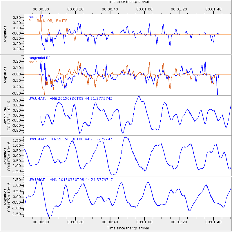
UMAT Pilot Rock, OR, USA - Earthquake Result Viewer
*The percent match for this event was below the threshold and hence no stack was calculated.
| Earthquake location: |
New Britain Region, P.N.G. |
| Earthquake latitude/longitude: |
-4.7/152.6 |
| Earthquake time(UTC): |
2015/03/30 (089) 08:31:46 GMT |
| Earthquake Depth: |
35 km |
| Earthquake Magnitude: |
5.3 mb, 5.2 mb, 5.7 MS |
| Earthquake Catalog/Contributor: |
ISC/ISC |
|
| Network: |
UW Pacific Northwest Regional Seismic Network |
| Station: |
UMAT Pilot Rock, OR, USA |
| Lat/Lon: |
45.29 N/118.96 W |
| Elevation: |
1318 m |
|
| Distance: |
92.2 deg |
| Az: |
44.924 deg |
| Baz: |
265.646 deg |
| Ray Param: |
$rayparam |
*The percent match for this event was below the threshold and hence was not used in the summary stack. |
|
| Radial Match: |
66.79663 % |
| Radial Bump: |
400 |
| Transverse Match: |
63.003857 % |
| Transverse Bump: |
400 |
| SOD ConfigId: |
7422571 |
| Insert Time: |
2019-04-18 00:08:05.243 +0000 |
| GWidth: |
2.5 |
| Max Bumps: |
400 |
| Tol: |
0.001 |
|
Signal To Noise
| Channel | StoN | STA | LTA |
| UW:UMAT: :HHZ:20150330T08:44:21.377974Z | 1.5885757 | 7.876867E-7 | 4.9584463E-7 |
| UW:UMAT: :HHN:20150330T08:44:21.377974Z | 1.9563408 | 1.1900911E-6 | 6.083251E-7 |
| UW:UMAT: :HHE:20150330T08:44:21.377974Z | 1.0415528 | 5.0791004E-7 | 4.876469E-7 |
| Arrivals |
| Ps | |
| PpPs | |
| PsPs/PpSs | |


