You are here: Home > Network List > TA - USArray Transportable Network (new EarthScope stations) Stations List
> Station H17A Grant Village (NPS), Yellowstone Nt. Park, WY, USA > Earthquake Result Viewer
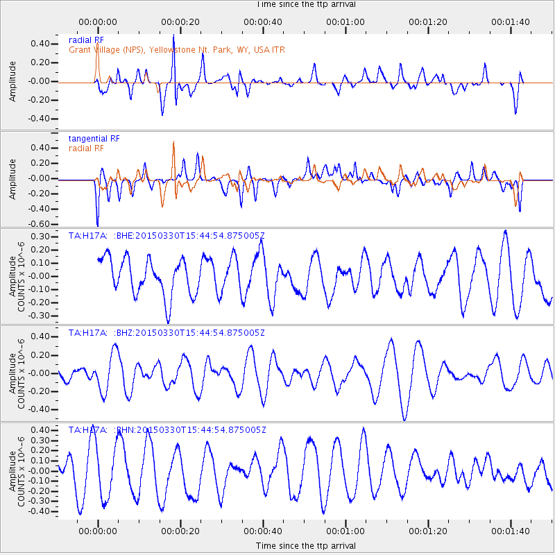
H17A Grant Village (NPS), Yellowstone Nt. Park, WY, USA - Earthquake Result Viewer
*The percent match for this event was below the threshold and hence no stack was calculated.
| Earthquake location: |
South Of Mariana Islands |
| Earthquake latitude/longitude: |
12.9/146.1 |
| Earthquake time(UTC): |
2015/03/30 (089) 15:32:28 GMT |
| Earthquake Depth: |
35 km |
| Earthquake Magnitude: |
4.9 mb, 4.9 mb, 3.8 MS |
| Earthquake Catalog/Contributor: |
ISC/ISC |
|
| Network: |
TA USArray Transportable Network (new EarthScope stations) |
| Station: |
H17A Grant Village (NPS), Yellowstone Nt. Park, WY, USA |
| Lat/Lon: |
44.40 N/110.58 W |
| Elevation: |
2400 m |
|
| Distance: |
90.4 deg |
| Az: |
44.24 deg |
| Baz: |
288.386 deg |
| Ray Param: |
$rayparam |
*The percent match for this event was below the threshold and hence was not used in the summary stack. |
|
| Radial Match: |
60.241962 % |
| Radial Bump: |
400 |
| Transverse Match: |
24.395767 % |
| Transverse Bump: |
400 |
| SOD ConfigId: |
7422571 |
| Insert Time: |
2019-04-18 00:21:01.055 +0000 |
| GWidth: |
2.5 |
| Max Bumps: |
400 |
| Tol: |
0.001 |
|
Signal To Noise
| Channel | StoN | STA | LTA |
| TA:H17A: :BHZ:20150330T15:44:54.875005Z | 1.858007 | 2.1700711E-7 | 1.1679565E-7 |
| TA:H17A: :BHN:20150330T15:44:54.875005Z | 1.8899968 | 2.711344E-7 | 1.4345761E-7 |
| TA:H17A: :BHE:20150330T15:44:54.875005Z | 0.97906494 | 1.3230766E-7 | 1.3513676E-7 |
| Arrivals |
| Ps | |
| PpPs | |
| PsPs/PpSs | |


