
RPN Rapanui, Easter Island, Chile - Earthquake Result Viewer
| ||||||||||||||||||
| ||||||||||||||||||
| ||||||||||||||||||
|
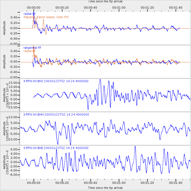
Signal To Noise
| Channel | StoN | STA | LTA |
| II:RPN:00:BHN:20030122T02:14:24.400009Z | 1.9702102 | 2.2023537E-6 | 1.1178267E-6 |
| II:RPN:00:BHE:20030122T02:14:24.400009Z | 1.1912901 | 1.3972424E-6 | 1.1728816E-6 |
| II:RPN:00:BHZ:20030122T02:14:24.400009Z | 1.5639459 | 2.8072122E-6 | 1.7949549E-6 |
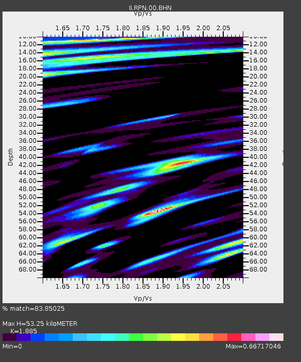
| Arrivals | |
| Ps | 11 SECOND |
| PpPs | 35 SECOND |
| PsPs/PpSs | 47 SECOND |

