You are here: Home > Network List > TA - USArray Transportable Network (new EarthScope stations) Stations List
> Station N25K Chitina, Valdez-Cordova, AK, USA > Earthquake Result Viewer
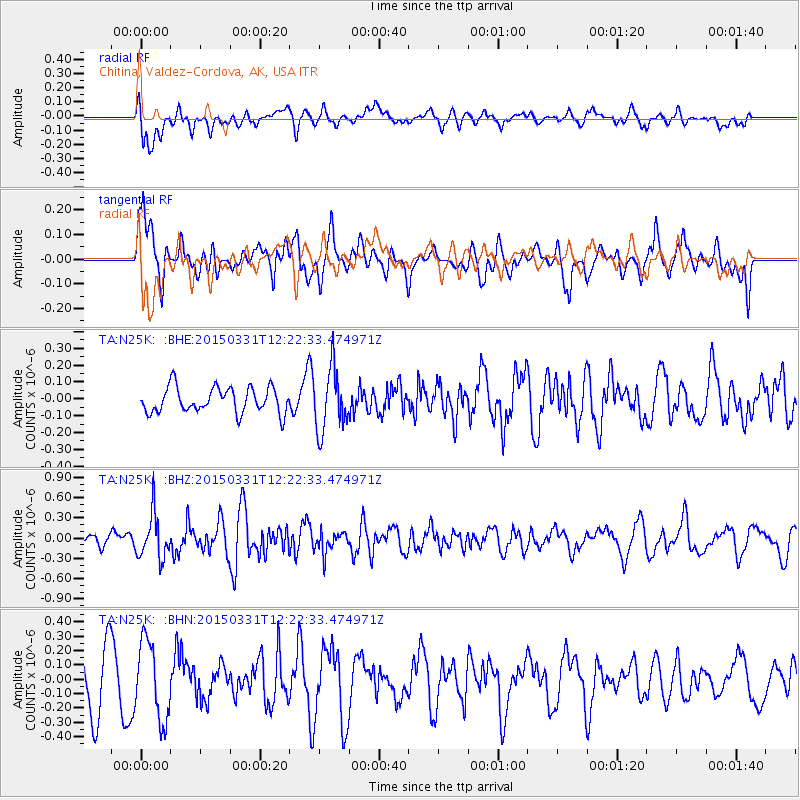
N25K Chitina, Valdez-Cordova, AK, USA - Earthquake Result Viewer
*The percent match for this event was below the threshold and hence no stack was calculated.
| Earthquake location: |
Solomon Islands |
| Earthquake latitude/longitude: |
-10.9/162.5 |
| Earthquake time(UTC): |
2015/03/31 (090) 12:10:43 GMT |
| Earthquake Depth: |
48 km |
| Earthquake Magnitude: |
5.8 MB |
| Earthquake Catalog/Contributor: |
NEIC PDE/NEIC COMCAT |
|
| Network: |
TA USArray Transportable Network (new EarthScope stations) |
| Station: |
N25K Chitina, Valdez-Cordova, AK, USA |
| Lat/Lon: |
61.61 N/144.60 W |
| Elevation: |
1087 m |
|
| Distance: |
83.2 deg |
| Az: |
22.592 deg |
| Baz: |
232.124 deg |
| Ray Param: |
$rayparam |
*The percent match for this event was below the threshold and hence was not used in the summary stack. |
|
| Radial Match: |
45.33567 % |
| Radial Bump: |
400 |
| Transverse Match: |
44.506943 % |
| Transverse Bump: |
400 |
| SOD ConfigId: |
7422571 |
| Insert Time: |
2019-04-18 00:32:15.460 +0000 |
| GWidth: |
2.5 |
| Max Bumps: |
400 |
| Tol: |
0.001 |
|
Signal To Noise
| Channel | StoN | STA | LTA |
| TA:N25K: :BHZ:20150331T12:22:33.474971Z | 2.8575885 | 3.2861453E-7 | 1.1499714E-7 |
| TA:N25K: :BHN:20150331T12:22:33.474971Z | 1.4028063 | 2.7231036E-7 | 1.941183E-7 |
| TA:N25K: :BHE:20150331T12:22:33.474971Z | 2.4474816 | 1.8328598E-7 | 7.488758E-8 |
| Arrivals |
| Ps | |
| PpPs | |
| PsPs/PpSs | |


