
RPN Rapanui, Easter Island, Chile - Earthquake Result Viewer
| ||||||||||||||||||
| ||||||||||||||||||
| ||||||||||||||||||
|
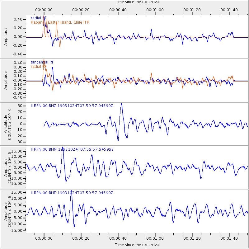
Signal To Noise
| Channel | StoN | STA | LTA |
| II:RPN:00:BHN:19931024T07:59:57.94599Z | 1.3034372 | 2.4268961E-6 | 1.86192E-6 |
| II:RPN:00:BHE:19931024T07:59:57.94599Z | 1.1265943 | 2.1717196E-6 | 1.9276856E-6 |
| II:RPN:00:BHZ:19931024T07:59:57.94599Z | 3.0215757 | 5.9422828E-6 | 1.9666174E-6 |
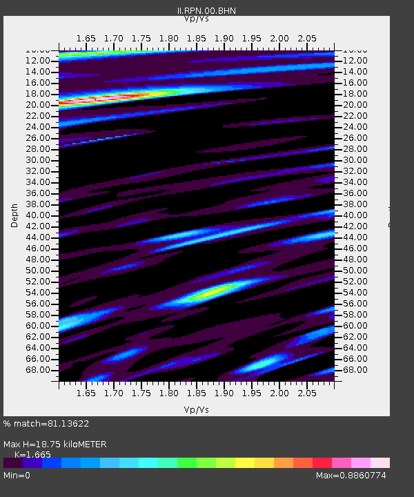
| Arrivals | |
| Ps | 3.0 SECOND |
| PpPs | 11 SECOND |
| PsPs/PpSs | 14 SECOND |

