You are here: Home > Network List > II - Global Seismograph Network (GSN - IRIS/IDA) Stations List
> Station RPN Rapanui, Easter Island, Chile > Earthquake Result Viewer
RPN Rapanui, Easter Island, Chile - Earthquake Result Viewer
| Earthquake location: |
Off Coast Of Northern Peru |
| Earthquake latitude/longitude: |
-9.6/-79.6 |
| Earthquake time(UTC): |
1996/02/21 (052) 12:51:04 GMT |
| Earthquake Depth: |
33 km |
| Earthquake Magnitude: |
5.8 MB, 6.6 MS, 7.5 UNKNOWN, 7.3 MW |
| Earthquake Catalog/Contributor: |
WHDF/NEIC |
|
| Network: |
II Global Seismograph Network (GSN - IRIS/IDA) |
| Station: |
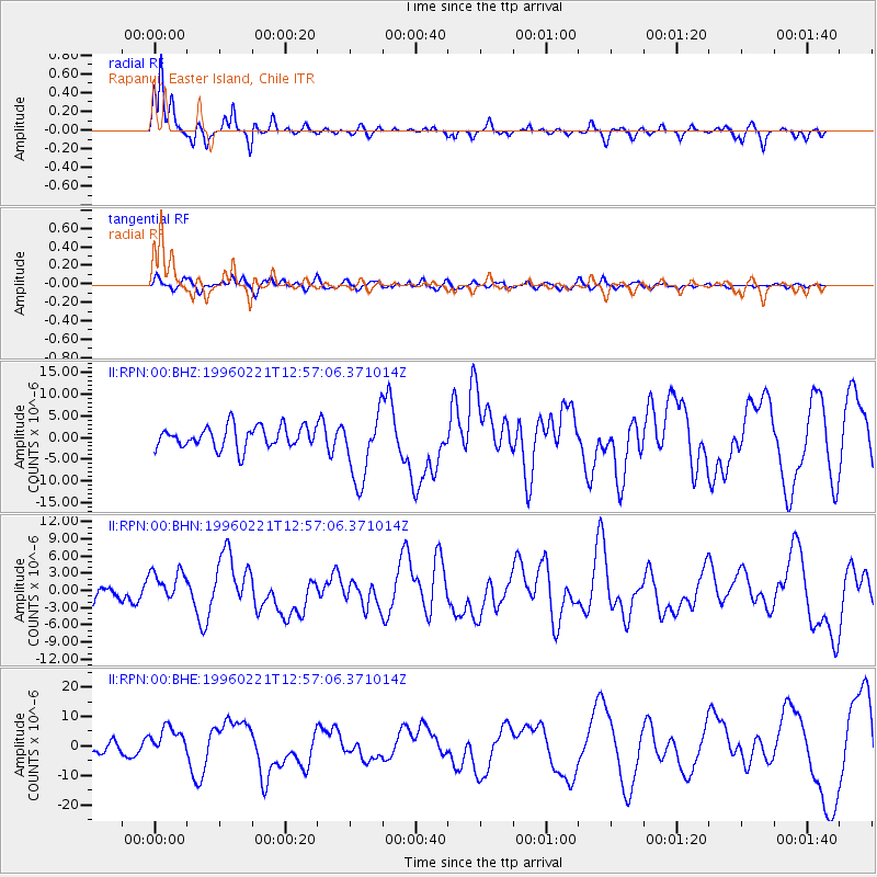
RPN Rapanui, Easter Island, Chile |
| Lat/Lon: |
27.13 S/109.33 W |
| Elevation: |
110 m |
|
| Distance: |
33.0 deg |
| Az: |
234.227 deg |
| Baz: |
63.86 deg |
| Ray Param: |
0.07833337 |
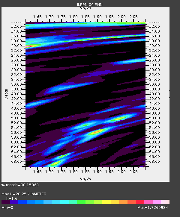
| Estimated Moho Depth: |
20.25 km |
| Estimated Crust Vp/Vs: |
1.60 |
| Assumed Crust Vp: |
4.24 km/s |
| Estimated Crust Vs: |
2.65 km/s |
| Estimated Crust Poisson's Ratio: |
0.18 |
|
| Radial Match: |
90.15063 % |
| Radial Bump: |
249 |
| Transverse Match: |
59.489643 % |
| Transverse Bump: |
400 |
| SOD ConfigId: |
6273 |
| Insert Time: |
2010-03-02 00:06:18.232 +0000 |
| GWidth: |
2.5 |
| Max Bumps: |
400 |
| Tol: |
0.001 |
|
Signal To Noise
| Channel | StoN | STA | LTA |
| II:RPN:00:BHN:19960221T12:57:06.371014Z | 2.02885 | 2.8563845E-6 | 1.4078836E-6 |
| II:RPN:00:BHE:19960221T12:57:06.371014Z | 2.574398 | 5.1278153E-6 | 1.9918502E-6 |
| II:RPN:00:BHZ:19960221T12:57:06.371014Z | 3.168524 | 7.9269E-6 | 2.5017646E-6 |
| Arrivals |
| Ps | 3.0 SECOND |
| PpPs | 12 SECOND |
| PsPs/PpSs | 15 SECOND |


