You are here: Home > Network List > TA - USArray Transportable Network (new EarthScope stations) Stations List
> Station R11A Troy Canyon, Currant, NV, USA > Earthquake Result Viewer
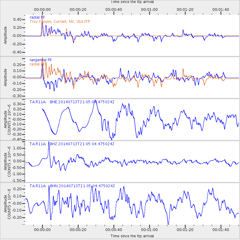
R11A Troy Canyon, Currant, NV, USA - Earthquake Result Viewer
*The percent match for this event was below the threshold and hence no stack was calculated.
| Earthquake location: |
Near Coast Of Northern Chile |
| Earthquake latitude/longitude: |
-20.2/-70.4 |
| Earthquake time(UTC): |
2014/07/13 (194) 20:54:14 GMT |
| Earthquake Depth: |
36 km |
| Earthquake Magnitude: |
6.1 M |
| Earthquake Catalog/Contributor: |
NEIC PDE/NEIC ALERT |
|
| Network: |
TA USArray Transportable Network (new EarthScope stations) |
| Station: |
R11A Troy Canyon, Currant, NV, USA |
| Lat/Lon: |
38.35 N/115.59 W |
| Elevation: |
1756 m |
|
| Distance: |
72.1 deg |
| Az: |
324.084 deg |
| Baz: |
135.531 deg |
| Ray Param: |
$rayparam |
*The percent match for this event was below the threshold and hence was not used in the summary stack. |
|
| Radial Match: |
87.43813 % |
| Radial Bump: |
400 |
| Transverse Match: |
83.57317 % |
| Transverse Bump: |
385 |
| SOD ConfigId: |
751272 |
| Insert Time: |
2014-07-27 21:54:12.209 +0000 |
| GWidth: |
2.5 |
| Max Bumps: |
400 |
| Tol: |
0.001 |
|
Signal To Noise
| Channel | StoN | STA | LTA |
| TA:R11A: :BHZ:20140713T21:05:04.475024Z | 3.4298265 | 5.2950907E-7 | 1.5438363E-7 |
| TA:R11A: :BHN:20140713T21:05:04.475024Z | 1.2260514 | 1.1081678E-7 | 9.03851E-8 |
| TA:R11A: :BHE:20140713T21:05:04.475024Z | 1.5167994 | 2.5152804E-7 | 1.6582815E-7 |
| Arrivals |
| Ps | |
| PpPs | |
| PsPs/PpSs | |


