You are here: Home > Network List > II - Global Seismograph Network (GSN - IRIS/IDA) Stations List
> Station RPN Rapanui, Easter Island, Chile > Earthquake Result Viewer
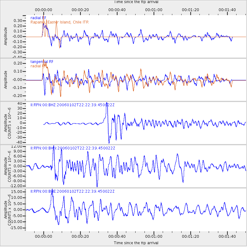
RPN Rapanui, Easter Island, Chile - Earthquake Result Viewer

| Earthquake location: |
Fiji Islands Region |
| Earthquake latitude/longitude: |
-19.9/-178.2 |
| Earthquake time(UTC): |
2006/01/02 (002) 22:13:40 GMT |
| Earthquake Depth: |
583 km |
| Earthquake Magnitude: |
6.5 MB, 7.2 MW, 7.1 MW |
| Earthquake Catalog/Contributor: |
WHDF/NEIC |
|
| Network: |
II Global Seismograph Network (GSN - IRIS/IDA) |
| Station: |
RPN Rapanui, Easter Island, Chile |
| Lat/Lon: |
27.13 S/109.33 W |
| Elevation: |
110 m |
|
| Distance: |
62.9 deg |
| Az: |
110.921 deg |
| Baz: |
260.43 deg |
| Ray Param: |
0.057730503 |
| Estimated Moho Depth: |
58.25 km |
| Estimated Crust Vp/Vs: |
1.80 |
| Assumed Crust Vp: |
4.24 km/s |
| Estimated Crust Vs: |
2.352 km/s |
| Estimated Crust Poisson's Ratio: |
0.28 |
|
| Radial Match: |
83.20996 % |
| Radial Bump: |
400 |
| Transverse Match: |
73.73316 % |
| Transverse Bump: |
400 |
| SOD ConfigId: |
2422 |
| Insert Time: |
2010-03-02 00:06:45.761 +0000 |
| GWidth: |
2.5 |
| Max Bumps: |
400 |
| Tol: |
0.001 |
|
Signal To Noise
| Channel | StoN | STA | LTA |
| II:RPN:00:BHN:20060102T22:22:39.450022Z | 0.90903956 | 8.554208E-7 | 9.410161E-7 |
| II:RPN:00:BHE:20060102T22:22:39.450022Z | 5.4908257 | 5.960529E-6 | 1.0855433E-6 |
| II:RPN:00:BHZ:20060102T22:22:39.450022Z | 12.233764 | 1.6313435E-5 | 1.3334763E-6 |
| Arrivals |
| Ps | 11 SECOND |
| PpPs | 38 SECOND |
| PsPs/PpSs | 49 SECOND |


