You are here: Home > Network List > CN - Canadian National Seismograph Network Stations List
> Station INK INUVIK, NT > Earthquake Result Viewer
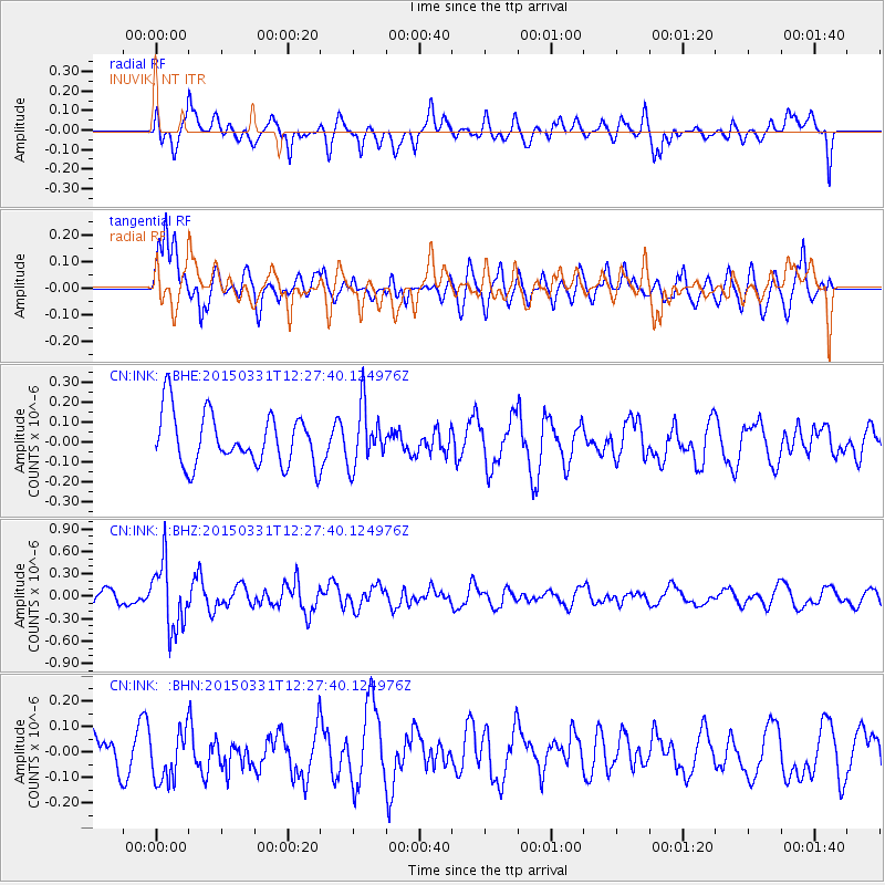
INK INUVIK, NT - Earthquake Result Viewer
*The percent match for this event was below the threshold and hence no stack was calculated.
| Earthquake location: |
New Britain Region, P.N.G. |
| Earthquake latitude/longitude: |
-4.9/152.6 |
| Earthquake time(UTC): |
2015/03/31 (090) 12:15:21 GMT |
| Earthquake Depth: |
35 km |
| Earthquake Magnitude: |
5.6 MB |
| Earthquake Catalog/Contributor: |
NEIC PDE/NEIC ALERT |
|
| Network: |
CN Canadian National Seismograph Network |
| Station: |
INK INUVIK, NT |
| Lat/Lon: |
68.31 N/133.53 W |
| Elevation: |
44 m |
|
| Distance: |
88.6 deg |
| Az: |
20.933 deg |
| Baz: |
253.23 deg |
| Ray Param: |
$rayparam |
*The percent match for this event was below the threshold and hence was not used in the summary stack. |
|
| Radial Match: |
50.18737 % |
| Radial Bump: |
400 |
| Transverse Match: |
69.98333 % |
| Transverse Bump: |
400 |
| SOD ConfigId: |
7422571 |
| Insert Time: |
2019-04-18 00:36:08.454 +0000 |
| GWidth: |
2.5 |
| Max Bumps: |
400 |
| Tol: |
0.001 |
|
Signal To Noise
| Channel | StoN | STA | LTA |
| CN:INK: :BHZ:20150331T12:27:40.124976Z | 3.2383323 | 4.346642E-7 | 1.342247E-7 |
| CN:INK: :BHN:20150331T12:27:40.124976Z | 0.99680907 | 1.0200433E-7 | 1.0233086E-7 |
| CN:INK: :BHE:20150331T12:27:40.124976Z | 1.123625 | 1.4642157E-7 | 1.3031178E-7 |
| Arrivals |
| Ps | |
| PpPs | |
| PsPs/PpSs | |


