You are here: Home > Network List > II - Global Seismograph Network (GSN - IRIS/IDA) Stations List
> Station RPN Rapanui, Easter Island, Chile > Earthquake Result Viewer
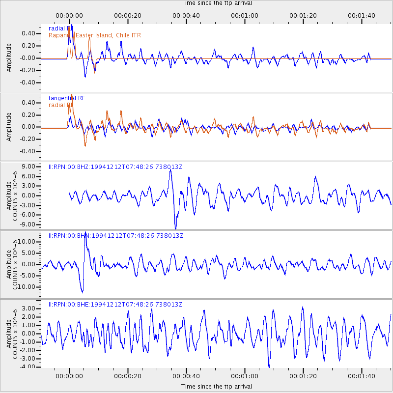
RPN Rapanui, Easter Island, Chile - Earthquake Result Viewer
*The percent match for this event was below the threshold and hence no stack was calculated.
| Earthquake location: |
Peru-Bolivia Border Region |
| Earthquake latitude/longitude: |
-17.5/-69.7 |
| Earthquake time(UTC): |
1994/12/12 (346) 07:41:55 GMT |
| Earthquake Depth: |
151 km |
| Earthquake Magnitude: |
5.8 MB, 6.1 UNKNOWN, 6.3 MW |
| Earthquake Catalog/Contributor: |
WHDF/NEIC |
|
| Network: |
II Global Seismograph Network (GSN - IRIS/IDA) |
| Station: |
RPN Rapanui, Easter Island, Chile |
| Lat/Lon: |
27.13 S/109.33 W |
| Elevation: |
110 m |
|
| Distance: |
37.8 deg |
| Az: |
248.188 deg |
| Baz: |
83.759 deg |
| Ray Param: |
$rayparam |
*The percent match for this event was below the threshold and hence was not used in the summary stack. |
|
| Radial Match: |
71.90988 % |
| Radial Bump: |
400 |
| Transverse Match: |
71.6119 % |
| Transverse Bump: |
400 |
| SOD ConfigId: |
4480 |
| Insert Time: |
2010-03-02 00:07:54.582 +0000 |
| GWidth: |
2.5 |
| Max Bumps: |
400 |
| Tol: |
0.001 |
|
Signal To Noise
| Channel | StoN | STA | LTA |
| II:RPN:00:BHN:19941212T07:48:26.738013Z | 4.843492 | 5.031468E-6 | 1.0388101E-6 |
| II:RPN:00:BHE:19941212T07:48:26.738013Z | 1.1504046 | 8.2120715E-7 | 7.1384204E-7 |
| II:RPN:00:BHZ:19941212T07:48:26.738013Z | 2.8830721 | 3.1425498E-6 | 1.0900004E-6 |
| Arrivals |
| Ps | |
| PpPs | |
| PsPs/PpSs | |


