You are here: Home > Network List > TA - USArray Transportable Network (new EarthScope stations) Stations List
> Station T57A Hurt, VA, USA > Earthquake Result Viewer
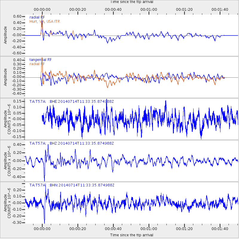
T57A Hurt, VA, USA - Earthquake Result Viewer
*The percent match for this event was below the threshold and hence no stack was calculated.
| Earthquake location: |
Off Coast Of Peru |
| Earthquake latitude/longitude: |
-17.9/-73.4 |
| Earthquake time(UTC): |
2014/07/14 (195) 11:24:39 GMT |
| Earthquake Depth: |
33 km |
| Earthquake Magnitude: |
5.5 M |
| Earthquake Catalog/Contributor: |
NEIC PDE/NEIC ALERT |
|
| Network: |
TA USArray Transportable Network (new EarthScope stations) |
| Station: |
T57A Hurt, VA, USA |
| Lat/Lon: |
37.00 N/79.25 W |
| Elevation: |
230 m |
|
| Distance: |
54.9 deg |
| Az: |
354.293 deg |
| Baz: |
173.208 deg |
| Ray Param: |
$rayparam |
*The percent match for this event was below the threshold and hence was not used in the summary stack. |
|
| Radial Match: |
52.18872 % |
| Radial Bump: |
400 |
| Transverse Match: |
50.24859 % |
| Transverse Bump: |
400 |
| SOD ConfigId: |
751272 |
| Insert Time: |
2014-07-28 12:13:02.067 +0000 |
| GWidth: |
2.5 |
| Max Bumps: |
400 |
| Tol: |
0.001 |
|
Signal To Noise
| Channel | StoN | STA | LTA |
| TA:T57A: :BHZ:20140714T11:33:35.874988Z | 3.6082873 | 1.8307878E-7 | 5.0738418E-8 |
| TA:T57A: :BHN:20140714T11:33:35.874988Z | 2.907509 | 1.2155596E-7 | 4.1807592E-8 |
| TA:T57A: :BHE:20140714T11:33:35.874988Z | 1.0440599 | 5.1745793E-8 | 4.9562093E-8 |
| Arrivals |
| Ps | |
| PpPs | |
| PsPs/PpSs | |


