You are here: Home > Network List > TA - USArray Transportable Network (new EarthScope stations) Stations List
> Station G05D Wamic, OR, USA > Earthquake Result Viewer
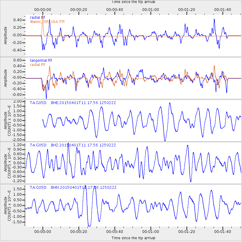
G05D Wamic, OR, USA - Earthquake Result Viewer
*The percent match for this event was below the threshold and hence no stack was calculated.
| Earthquake location: |
Samoa Islands Region |
| Earthquake latitude/longitude: |
-16.0/-172.8 |
| Earthquake time(UTC): |
2015/04/01 (091) 11:06:35 GMT |
| Earthquake Depth: |
10 km |
| Earthquake Magnitude: |
5.5 MWC, 5.5 MWC |
| Earthquake Catalog/Contributor: |
NEIC PDE/NEIC COMCAT |
|
| Network: |
TA USArray Transportable Network (new EarthScope stations) |
| Station: |
G05D Wamic, OR, USA |
| Lat/Lon: |
45.24 N/121.32 W |
| Elevation: |
592 m |
|
| Distance: |
76.8 deg |
| Az: |
34.617 deg |
| Baz: |
230.648 deg |
| Ray Param: |
$rayparam |
*The percent match for this event was below the threshold and hence was not used in the summary stack. |
|
| Radial Match: |
62.798668 % |
| Radial Bump: |
306 |
| Transverse Match: |
76.73174 % |
| Transverse Bump: |
376 |
| SOD ConfigId: |
7422571 |
| Insert Time: |
2019-04-18 01:07:45.796 +0000 |
| GWidth: |
2.5 |
| Max Bumps: |
400 |
| Tol: |
0.001 |
|
Signal To Noise
| Channel | StoN | STA | LTA |
| TA:G05D: :BHZ:20150401T11:17:56.125022Z | 1.7746346 | 5.394438E-7 | 3.039746E-7 |
| TA:G05D: :BHN:20150401T11:17:56.125022Z | 0.65923375 | 3.5702485E-7 | 5.415755E-7 |
| TA:G05D: :BHE:20150401T11:17:56.125022Z | 2.857335 | 1.1268504E-6 | 3.943711E-7 |
| Arrivals |
| Ps | |
| PpPs | |
| PsPs/PpSs | |


