You are here: Home > Network List > US - United States National Seismic Network Stations List
> Station LAO LASA Array, Montana, USA > Earthquake Result Viewer
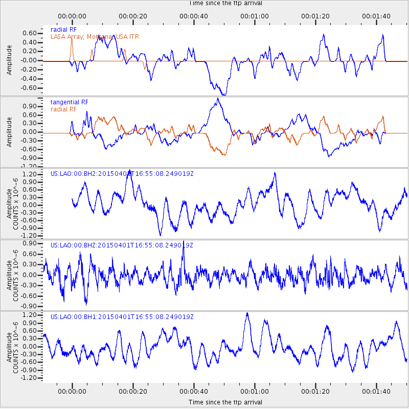
LAO LASA Array, Montana, USA - Earthquake Result Viewer
*The percent match for this event was below the threshold and hence no stack was calculated.
| Earthquake location: |
Near Coast Of Peru |
| Earthquake latitude/longitude: |
-10.6/-78.0 |
| Earthquake time(UTC): |
2015/04/01 (091) 16:45:21 GMT |
| Earthquake Depth: |
48 km |
| Earthquake Magnitude: |
5.5 MW |
| Earthquake Catalog/Contributor: |
ISC/ISC |
|
| Network: |
US United States National Seismic Network |
| Station: |
LAO LASA Array, Montana, USA |
| Lat/Lon: |
46.69 N/106.22 W |
| Elevation: |
902 m |
|
| Distance: |
62.3 deg |
| Az: |
338.444 deg |
| Baz: |
148.345 deg |
| Ray Param: |
$rayparam |
*The percent match for this event was below the threshold and hence was not used in the summary stack. |
|
| Radial Match: |
46.784855 % |
| Radial Bump: |
400 |
| Transverse Match: |
39.875397 % |
| Transverse Bump: |
400 |
| SOD ConfigId: |
7422571 |
| Insert Time: |
2019-04-18 01:15:05.275 +0000 |
| GWidth: |
2.5 |
| Max Bumps: |
400 |
| Tol: |
0.001 |
|
Signal To Noise
| Channel | StoN | STA | LTA |
| US:LAO:00:BHZ:20150401T16:55:08.249019Z | 1.9193755 | 3.842996E-7 | 2.0022117E-7 |
| US:LAO:00:BH1:20150401T16:55:08.249019Z | 1.2604952 | 4.8180533E-7 | 3.8223493E-7 |
| US:LAO:00:BH2:20150401T16:55:08.249019Z | 2.4749768 | 9.773031E-7 | 3.9487364E-7 |
| Arrivals |
| Ps | |
| PpPs | |
| PsPs/PpSs | |


