You are here: Home > Network List > US - United States National Seismic Network Stations List
> Station MSO Missoula, Montana, USA > Earthquake Result Viewer
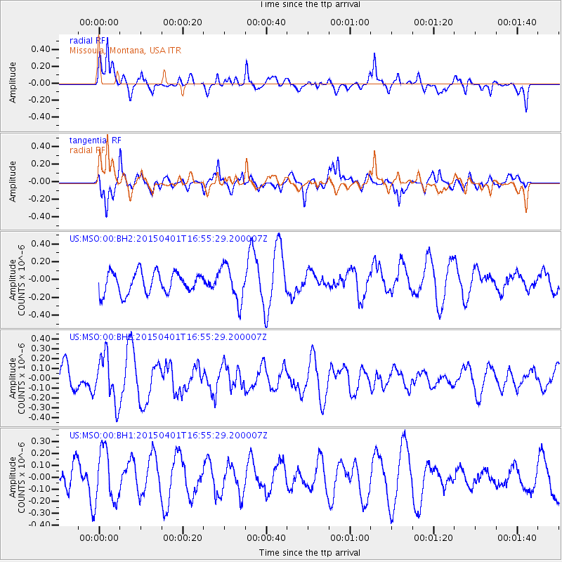
MSO Missoula, Montana, USA - Earthquake Result Viewer
*The percent match for this event was below the threshold and hence no stack was calculated.
| Earthquake location: |
Near Coast Of Peru |
| Earthquake latitude/longitude: |
-10.6/-78.0 |
| Earthquake time(UTC): |
2015/04/01 (091) 16:45:21 GMT |
| Earthquake Depth: |
48 km |
| Earthquake Magnitude: |
5.5 MW |
| Earthquake Catalog/Contributor: |
ISC/ISC |
|
| Network: |
US United States National Seismic Network |
| Station: |
MSO Missoula, Montana, USA |
| Lat/Lon: |
46.83 N/113.94 W |
| Elevation: |
1264 m |
|
| Distance: |
65.5 deg |
| Az: |
333.728 deg |
| Baz: |
140.662 deg |
| Ray Param: |
$rayparam |
*The percent match for this event was below the threshold and hence was not used in the summary stack. |
|
| Radial Match: |
55.150898 % |
| Radial Bump: |
400 |
| Transverse Match: |
45.83899 % |
| Transverse Bump: |
400 |
| SOD ConfigId: |
7422571 |
| Insert Time: |
2019-04-18 01:15:07.145 +0000 |
| GWidth: |
2.5 |
| Max Bumps: |
400 |
| Tol: |
0.001 |
|
Signal To Noise
| Channel | StoN | STA | LTA |
| US:MSO:00:BHZ:20150401T16:55:29.200007Z | 1.9729941 | 2.416578E-7 | 1.2248279E-7 |
| US:MSO:00:BH1:20150401T16:55:29.200007Z | 2.7331123 | 2.1587616E-7 | 7.8985465E-8 |
| US:MSO:00:BH2:20150401T16:55:29.200007Z | 1.721193 | 2.0401492E-7 | 1.1853112E-7 |
| Arrivals |
| Ps | |
| PpPs | |
| PsPs/PpSs | |


