You are here: Home > Network List > TA - USArray Transportable Network (new EarthScope stations) Stations List
> Station X43A Marvell, AR, USA > Earthquake Result Viewer
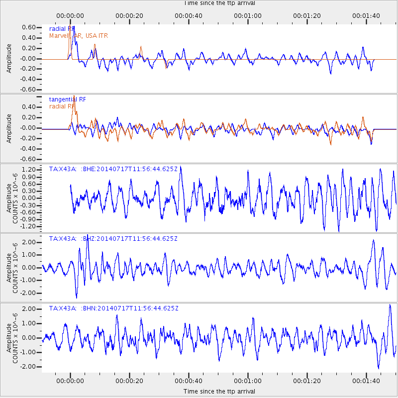
X43A Marvell, AR, USA - Earthquake Result Viewer
*The percent match for this event was below the threshold and hence no stack was calculated.
| Earthquake location: |
Southeastern Alaska |
| Earthquake latitude/longitude: |
60.4/-140.3 |
| Earthquake time(UTC): |
2014/07/17 (198) 11:49:32 GMT |
| Earthquake Depth: |
0.6 km |
| Earthquake Magnitude: |
5.8 MI |
| Earthquake Catalog/Contributor: |
NEIC PDE/NEIC ALERT |
|
| Network: |
TA USArray Transportable Network (new EarthScope stations) |
| Station: |
X43A Marvell, AR, USA |
| Lat/Lon: |
34.52 N/90.88 W |
| Elevation: |
53 m |
|
| Distance: |
40.9 deg |
| Az: |
106.464 deg |
| Baz: |
324.756 deg |
| Ray Param: |
$rayparam |
*The percent match for this event was below the threshold and hence was not used in the summary stack. |
|
| Radial Match: |
61.886883 % |
| Radial Bump: |
400 |
| Transverse Match: |
55.564423 % |
| Transverse Bump: |
394 |
| SOD ConfigId: |
751272 |
| Insert Time: |
2014-07-31 12:46:14.113 +0000 |
| GWidth: |
2.5 |
| Max Bumps: |
400 |
| Tol: |
0.001 |
|
Signal To Noise
| Channel | StoN | STA | LTA |
| TA:X43A: :BHZ:20140717T11:56:44.625Z | 4.897397 | 9.208235E-7 | 1.8802304E-7 |
| TA:X43A: :BHN:20140717T11:56:44.625Z | 1.6409631 | 5.112062E-7 | 3.1152817E-7 |
| TA:X43A: :BHE:20140717T11:56:44.625Z | 1.4216256 | 4.7330397E-7 | 3.329315E-7 |
| Arrivals |
| Ps | |
| PpPs | |
| PsPs/PpSs | |


