You are here: Home > Network List > TA - USArray Transportable Network (new EarthScope stations) Stations List
> Station Z56A Williston, SC, USA > Earthquake Result Viewer
Z56A Williston, SC, USA - Earthquake Result Viewer

| Earthquake location: |
Southeastern Alaska |
| Earthquake latitude/longitude: |
60.4/-140.3 |
| Earthquake time(UTC): |
2014/07/17 (198) 11:49:32 GMT |
| Earthquake Depth: |
0.6 km |
| Earthquake Magnitude: |
5.8 MI |
| Earthquake Catalog/Contributor: |
NEIC PDE/NEIC ALERT |
|
| Network: |
TA USArray Transportable Network (new EarthScope stations) |
| Station: |
Z56A Williston, SC, USA |
| Lat/Lon: |
33.33 N/81.37 W |
| Elevation: |
81 m |
|
| Distance: |
46.5 deg |
| Az: |
98.153 deg |
| Baz: |
324.024 deg |
| Ray Param: |
0.07065839 |
| Estimated Moho Depth: |
42.25 km |
| Estimated Crust Vp/Vs: |
1.65 |
| Assumed Crust Vp: |
6.565 km/s |
| Estimated Crust Vs: |
3.978 km/s |
| Estimated Crust Poisson's Ratio: |
0.21 |
|
| Radial Match: |
82.671036 % |
| Radial Bump: |
400 |
| Transverse Match: |
67.93014 % |
| Transverse Bump: |
400 |
| SOD ConfigId: |
751272 |
| Insert Time: |
2014-07-31 12:46:58.009 +0000 |
| GWidth: |
2.5 |
| Max Bumps: |
400 |
| Tol: |
0.001 |
|
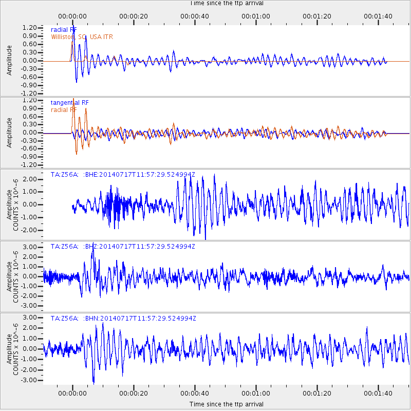
Signal To Noise
| Channel | StoN | STA | LTA |
| TA:Z56A: :BHZ:20140717T11:57:29.524994Z | 1.8952656 | 7.498088E-7 | 3.9562204E-7 |
| TA:Z56A: :BHN:20140717T11:57:29.524994Z | 1.3233935 | 6.419145E-7 | 4.850519E-7 |
| TA:Z56A: :BHE:20140717T11:57:29.524994Z | 1.2760785 | 6.675346E-7 | 5.2311407E-7 |
| Arrivals |
| Ps | 4.5 SECOND |
| PpPs | 16 SECOND |
| PsPs/PpSs | 20 SECOND |


