You are here: Home > Network List > US - United States National Seismic Network Stations List
> Station AMTX Amarillo, Texas, USA > Earthquake Result Viewer
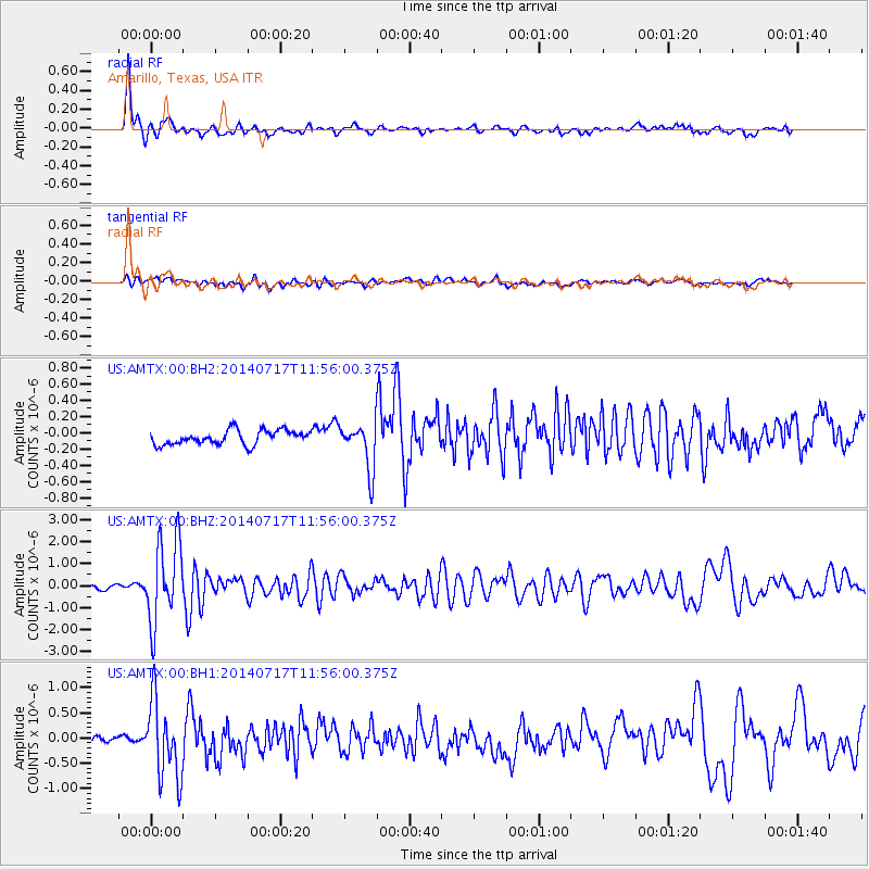
AMTX Amarillo, Texas, USA - Earthquake Result Viewer
*The percent match for this event was below the threshold and hence no stack was calculated.
| Earthquake location: |
Southeastern Alaska |
| Earthquake latitude/longitude: |
60.4/-140.3 |
| Earthquake time(UTC): |
2014/07/17 (198) 11:49:32 GMT |
| Earthquake Depth: |
0.6 km |
| Earthquake Magnitude: |
5.8 MI |
| Earthquake Catalog/Contributor: |
NEIC PDE/NEIC ALERT |
|
| Network: |
US United States National Seismic Network |
| Station: |
AMTX Amarillo, Texas, USA |
| Lat/Lon: |
34.53 N/101.41 W |
| Elevation: |
1010 m |
|
| Distance: |
36.0 deg |
| Az: |
118.093 deg |
| Baz: |
327.933 deg |
| Ray Param: |
$rayparam |
*The percent match for this event was below the threshold and hence was not used in the summary stack. |
|
| Radial Match: |
89.37965 % |
| Radial Bump: |
391 |
| Transverse Match: |
61.476086 % |
| Transverse Bump: |
400 |
| SOD ConfigId: |
751272 |
| Insert Time: |
2014-07-31 12:48:10.020 +0000 |
| GWidth: |
2.5 |
| Max Bumps: |
400 |
| Tol: |
0.001 |
|
Signal To Noise
| Channel | StoN | STA | LTA |
| US:AMTX:00:BHZ:20140717T11:56:00.375Z | 21.134052 | 1.8447903E-6 | 8.728994E-8 |
| US:AMTX:00:BH1:20140717T11:56:00.375Z | 13.435456 | 7.569371E-7 | 5.633877E-8 |
| US:AMTX:00:BH2:20140717T11:56:00.375Z | 5.342551 | 4.857881E-7 | 9.092811E-8 |
| Arrivals |
| Ps | |
| PpPs | |
| PsPs/PpSs | |


