You are here: Home > Network List > US - United States National Seismic Network Stations List
> Station HAWA Hanford, Washington, USA > Earthquake Result Viewer
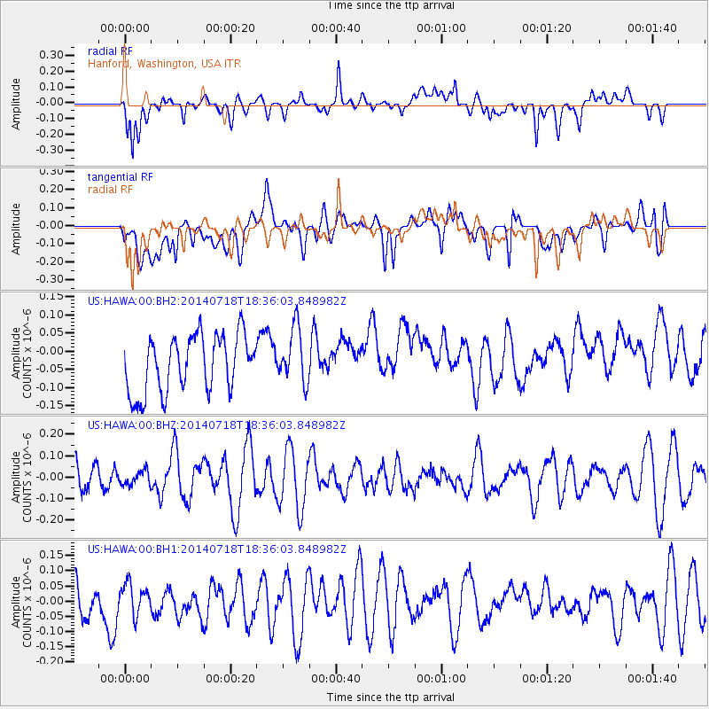
HAWA Hanford, Washington, USA - Earthquake Result Viewer
*The percent match for this event was below the threshold and hence no stack was calculated.
| Earthquake location: |
South Of Kermadec Islands |
| Earthquake latitude/longitude: |
-34.6/-179.6 |
| Earthquake time(UTC): |
2014/07/18 (199) 18:23:06 GMT |
| Earthquake Depth: |
34 km |
| Earthquake Magnitude: |
5.6 MB |
| Earthquake Catalog/Contributor: |
NEIC PDE/NEIC COMCAT |
|
| Network: |
US United States National Seismic Network |
| Station: |
HAWA Hanford, Washington, USA |
| Lat/Lon: |
46.39 N/119.53 W |
| Elevation: |
364 m |
|
| Distance: |
97.1 deg |
| Az: |
37.197 deg |
| Baz: |
226.065 deg |
| Ray Param: |
$rayparam |
*The percent match for this event was below the threshold and hence was not used in the summary stack. |
|
| Radial Match: |
60.63889 % |
| Radial Bump: |
400 |
| Transverse Match: |
42.00539 % |
| Transverse Bump: |
400 |
| SOD ConfigId: |
751272 |
| Insert Time: |
2014-08-01 19:17:53.991 +0000 |
| GWidth: |
2.5 |
| Max Bumps: |
400 |
| Tol: |
0.001 |
|
Signal To Noise
| Channel | StoN | STA | LTA |
| US:HAWA:00:BHZ:20140718T18:36:03.848982Z | 0.33099562 | 3.2618242E-8 | 9.854585E-8 |
| US:HAWA:00:BH1:20140718T18:36:03.848982Z | 0.80806476 | 4.7285763E-8 | 5.8517294E-8 |
| US:HAWA:00:BH2:20140718T18:36:03.848982Z | 0.9863423 | 7.733451E-8 | 7.840535E-8 |
| Arrivals |
| Ps | |
| PpPs | |
| PsPs/PpSs | |


