You are here: Home > Network List > HV - Hawaiian Volcano Observatory Network Stations List
> Station MLOD Mauna Loa, Hawaii Digital > Earthquake Result Viewer
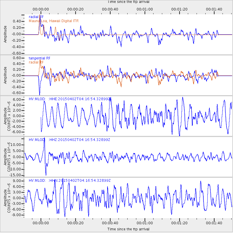
MLOD Mauna Loa, Hawaii Digital - Earthquake Result Viewer
*The percent match for this event was below the threshold and hence no stack was calculated.
| Earthquake location: |
Fiji Islands Region |
| Earthquake latitude/longitude: |
-17.8/-178.7 |
| Earthquake time(UTC): |
2015/04/02 (092) 04:10:09 GMT |
| Earthquake Depth: |
536 km |
| Earthquake Magnitude: |
6.0 MWP |
| Earthquake Catalog/Contributor: |
NEIC PDE/NEIC COMCAT |
|
| Network: |
HV Hawaiian Volcano Observatory Network |
| Station: |
MLOD Mauna Loa, Hawaii Digital |
| Lat/Lon: |
19.49 N/155.39 W |
| Elevation: |
2044 m |
|
| Distance: |
43.5 deg |
| Az: |
32.768 deg |
| Baz: |
213.134 deg |
| Ray Param: |
$rayparam |
*The percent match for this event was below the threshold and hence was not used in the summary stack. |
|
| Radial Match: |
52.343086 % |
| Radial Bump: |
400 |
| Transverse Match: |
64.99822 % |
| Transverse Bump: |
400 |
| SOD ConfigId: |
7422571 |
| Insert Time: |
2019-04-18 01:20:56.044 +0000 |
| GWidth: |
2.5 |
| Max Bumps: |
400 |
| Tol: |
0.001 |
|
Signal To Noise
| Channel | StoN | STA | LTA |
| HV:MLOD: :HHZ:20150402T04:16:54.32899Z | 2.7256374 | 6.887382E-6 | 2.5268887E-6 |
| HV:MLOD: :HHN:20150402T04:16:54.32899Z | 0.8395107 | 2.2108027E-6 | 2.633442E-6 |
| HV:MLOD: :HHE:20150402T04:16:54.32899Z | 0.8562785 | 2.3708365E-6 | 2.7687681E-6 |
| Arrivals |
| Ps | |
| PpPs | |
| PsPs/PpSs | |


