You are here: Home > Network List > TA - USArray Transportable Network (new EarthScope stations) Stations List
> Station J01E Myrtle Point, OR, USA > Earthquake Result Viewer
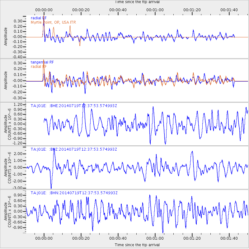
J01E Myrtle Point, OR, USA - Earthquake Result Viewer
*The percent match for this event was below the threshold and hence no stack was calculated.
| Earthquake location: |
Tonga Islands |
| Earthquake latitude/longitude: |
-15.8/-174.4 |
| Earthquake time(UTC): |
2014/07/19 (200) 12:27:09 GMT |
| Earthquake Depth: |
220 km |
| Earthquake Magnitude: |
6.0 MWP |
| Earthquake Catalog/Contributor: |
NEIC PDE/NEIC COMCAT |
|
| Network: |
TA USArray Transportable Network (new EarthScope stations) |
| Station: |
J01E Myrtle Point, OR, USA |
| Lat/Lon: |
43.16 N/123.93 W |
| Elevation: |
128 m |
|
| Distance: |
74.7 deg |
| Az: |
35.812 deg |
| Baz: |
230.34 deg |
| Ray Param: |
$rayparam |
*The percent match for this event was below the threshold and hence was not used in the summary stack. |
|
| Radial Match: |
54.134407 % |
| Radial Bump: |
400 |
| Transverse Match: |
55.598125 % |
| Transverse Bump: |
400 |
| SOD ConfigId: |
751272 |
| Insert Time: |
2014-08-02 13:25:30.809 +0000 |
| GWidth: |
2.5 |
| Max Bumps: |
400 |
| Tol: |
0.001 |
|
Signal To Noise
| Channel | StoN | STA | LTA |
| TA:J01E: :BHZ:20140719T12:37:53.574993Z | 1.8614144 | 9.951856E-7 | 5.346394E-7 |
| TA:J01E: :BHN:20140719T12:37:53.574993Z | 1.2438867 | 2.5031295E-7 | 2.0123451E-7 |
| TA:J01E: :BHE:20140719T12:37:53.574993Z | 0.82712716 | 3.5209996E-7 | 4.2569025E-7 |
| Arrivals |
| Ps | |
| PpPs | |
| PsPs/PpSs | |


