You are here: Home > Network List > TA - USArray Transportable Network (new EarthScope stations) Stations List
> Station MDND Maddock, ND, USA > Earthquake Result Viewer
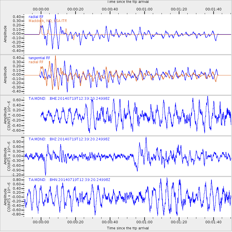
MDND Maddock, ND, USA - Earthquake Result Viewer
*The percent match for this event was below the threshold and hence no stack was calculated.
| Earthquake location: |
Tonga Islands |
| Earthquake latitude/longitude: |
-15.8/-174.4 |
| Earthquake time(UTC): |
2014/07/19 (200) 12:27:09 GMT |
| Earthquake Depth: |
220 km |
| Earthquake Magnitude: |
6.0 MWP |
| Earthquake Catalog/Contributor: |
NEIC PDE/NEIC COMCAT |
|
| Network: |
TA USArray Transportable Network (new EarthScope stations) |
| Station: |
MDND Maddock, ND, USA |
| Lat/Lon: |
47.85 N/99.60 W |
| Elevation: |
479 m |
|
| Distance: |
91.7 deg |
| Az: |
40.565 deg |
| Baz: |
248.348 deg |
| Ray Param: |
$rayparam |
*The percent match for this event was below the threshold and hence was not used in the summary stack. |
|
| Radial Match: |
53.195385 % |
| Radial Bump: |
370 |
| Transverse Match: |
68.74636 % |
| Transverse Bump: |
376 |
| SOD ConfigId: |
751272 |
| Insert Time: |
2014-08-02 13:26:16.326 +0000 |
| GWidth: |
2.5 |
| Max Bumps: |
400 |
| Tol: |
0.001 |
|
Signal To Noise
| Channel | StoN | STA | LTA |
| TA:MDND: :BHZ:20140719T12:39:20.24998Z | 4.690165 | 4.239601E-7 | 9.039343E-8 |
| TA:MDND: :BHN:20140719T12:39:20.24998Z | 1.2371904 | 2.567242E-7 | 2.075058E-7 |
| TA:MDND: :BHE:20140719T12:39:20.24998Z | 2.0632648 | 3.3447495E-7 | 1.6210956E-7 |
| Arrivals |
| Ps | |
| PpPs | |
| PsPs/PpSs | |


