You are here: Home > Network List > US - United States National Seismic Network Stations List
> Station DGMT Dagmar, Montana, USA > Earthquake Result Viewer
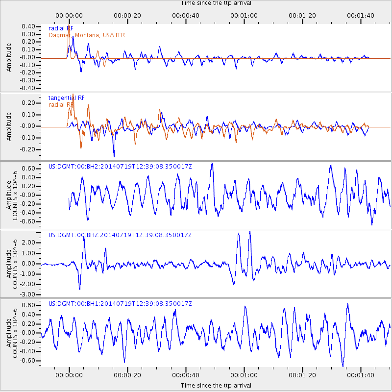
DGMT Dagmar, Montana, USA - Earthquake Result Viewer
*The percent match for this event was below the threshold and hence no stack was calculated.
| Earthquake location: |
Tonga Islands |
| Earthquake latitude/longitude: |
-15.8/-174.4 |
| Earthquake time(UTC): |
2014/07/19 (200) 12:27:09 GMT |
| Earthquake Depth: |
220 km |
| Earthquake Magnitude: |
6.0 MWP |
| Earthquake Catalog/Contributor: |
NEIC PDE/NEIC COMCAT |
|
| Network: |
US United States National Seismic Network |
| Station: |
DGMT Dagmar, Montana, USA |
| Lat/Lon: |
48.47 N/104.20 W |
| Elevation: |
0.0 m |
|
| Distance: |
89.1 deg |
| Az: |
38.775 deg |
| Baz: |
244.95 deg |
| Ray Param: |
$rayparam |
*The percent match for this event was below the threshold and hence was not used in the summary stack. |
|
| Radial Match: |
74.542984 % |
| Radial Bump: |
400 |
| Transverse Match: |
59.0268 % |
| Transverse Bump: |
374 |
| SOD ConfigId: |
751272 |
| Insert Time: |
2014-08-02 13:29:13.636 +0000 |
| GWidth: |
2.5 |
| Max Bumps: |
400 |
| Tol: |
0.001 |
|
Signal To Noise
| Channel | StoN | STA | LTA |
| US:DGMT:00:BHZ:20140719T12:39:08.350017Z | 9.989173 | 8.675483E-7 | 8.6848864E-8 |
| US:DGMT:00:BH1:20140719T12:39:08.350017Z | 1.11806 | 2.1233029E-7 | 1.8990956E-7 |
| US:DGMT:00:BH2:20140719T12:39:08.350017Z | 1.1059878 | 2.3608234E-7 | 2.1345836E-7 |
| Arrivals |
| Ps | |
| PpPs | |
| PsPs/PpSs | |


