You are here: Home > Network List > UW - Pacific Northwest Regional Seismic Network Stations List
> Station MRBL Marblemount, WA, USA > Earthquake Result Viewer
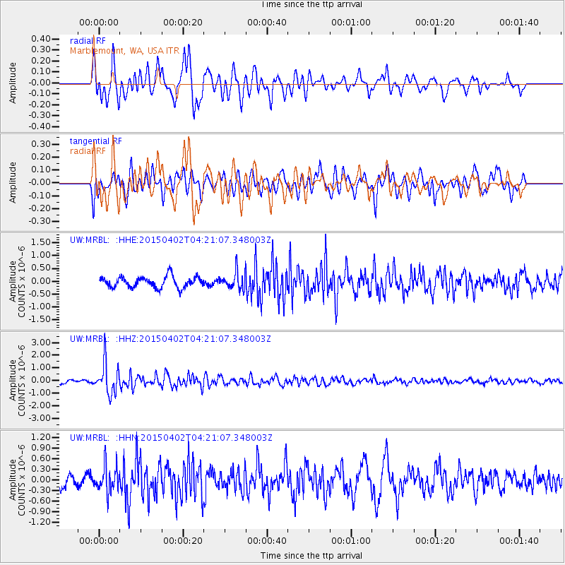
MRBL Marblemount, WA, USA - Earthquake Result Viewer
*The percent match for this event was below the threshold and hence no stack was calculated.
| Earthquake location: |
Fiji Islands Region |
| Earthquake latitude/longitude: |
-17.8/-178.7 |
| Earthquake time(UTC): |
2015/04/02 (092) 04:10:09 GMT |
| Earthquake Depth: |
536 km |
| Earthquake Magnitude: |
6.0 MWP |
| Earthquake Catalog/Contributor: |
NEIC PDE/NEIC COMCAT |
|
| Network: |
UW Pacific Northwest Regional Seismic Network |
| Station: |
MRBL Marblemount, WA, USA |
| Lat/Lon: |
48.52 N/121.48 W |
| Elevation: |
75 m |
|
| Distance: |
83.3 deg |
| Az: |
34.235 deg |
| Baz: |
233.722 deg |
| Ray Param: |
$rayparam |
*The percent match for this event was below the threshold and hence was not used in the summary stack. |
|
| Radial Match: |
81.341515 % |
| Radial Bump: |
400 |
| Transverse Match: |
65.71931 % |
| Transverse Bump: |
400 |
| SOD ConfigId: |
7422571 |
| Insert Time: |
2019-04-18 01:25:06.519 +0000 |
| GWidth: |
2.5 |
| Max Bumps: |
400 |
| Tol: |
0.001 |
|
Signal To Noise
| Channel | StoN | STA | LTA |
| UW:MRBL: :HHZ:20150402T04:21:07.348003Z | 6.360096 | 1.2529292E-6 | 1.9699847E-7 |
| UW:MRBL: :HHN:20150402T04:21:07.348003Z | 2.6954212 | 3.8283181E-7 | 1.4203042E-7 |
| UW:MRBL: :HHE:20150402T04:21:07.348003Z | 1.927588 | 4.0547124E-7 | 2.1035162E-7 |
| Arrivals |
| Ps | |
| PpPs | |
| PsPs/PpSs | |


