You are here: Home > Network List > UW - Pacific Northwest Regional Seismic Network Stations List
> Station MRBL Marblemount, WA, USA > Earthquake Result Viewer
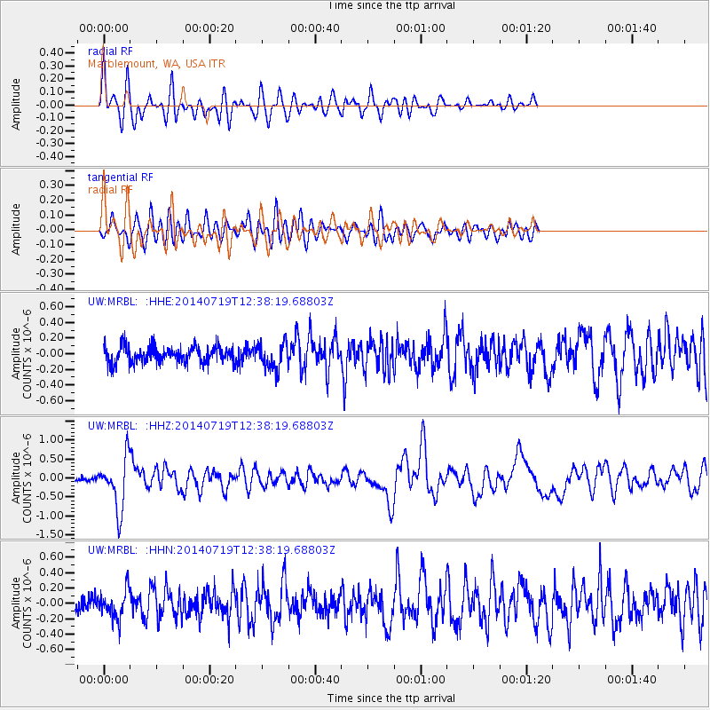
MRBL Marblemount, WA, USA - Earthquake Result Viewer
*The percent match for this event was below the threshold and hence no stack was calculated.
| Earthquake location: |
Tonga Islands |
| Earthquake latitude/longitude: |
-15.8/-174.4 |
| Earthquake time(UTC): |
2014/07/19 (200) 12:27:09 GMT |
| Earthquake Depth: |
220 km |
| Earthquake Magnitude: |
6.0 MWP |
| Earthquake Catalog/Contributor: |
NEIC PDE/NEIC COMCAT |
|
| Network: |
UW Pacific Northwest Regional Seismic Network |
| Station: |
MRBL Marblemount, WA, USA |
| Lat/Lon: |
48.52 N/121.48 W |
| Elevation: |
75 m |
|
| Distance: |
79.4 deg |
| Az: |
32.658 deg |
| Baz: |
231.384 deg |
| Ray Param: |
$rayparam |
*The percent match for this event was below the threshold and hence was not used in the summary stack. |
|
| Radial Match: |
78.77488 % |
| Radial Bump: |
400 |
| Transverse Match: |
72.7794 % |
| Transverse Bump: |
400 |
| SOD ConfigId: |
751272 |
| Insert Time: |
2014-08-02 13:34:46.393 +0000 |
| GWidth: |
2.5 |
| Max Bumps: |
400 |
| Tol: |
0.001 |
|
Signal To Noise
| Channel | StoN | STA | LTA |
| UW:MRBL: :HHZ:20140719T12:38:19.68803Z | 10.467233 | 6.9258977E-7 | 6.616742E-8 |
| UW:MRBL: :HHN:20140719T12:38:19.68803Z | 1.7686816 | 1.8354314E-7 | 1.03773985E-7 |
| UW:MRBL: :HHE:20140719T12:38:19.68803Z | 1.5961313 | 1.6879167E-7 | 1.05750495E-7 |
| Arrivals |
| Ps | |
| PpPs | |
| PsPs/PpSs | |


