You are here: Home > Network List > CI - Caltech Regional Seismic Network Stations List
> Station MPM Manuel Prospect Mine, California, USA > Earthquake Result Viewer
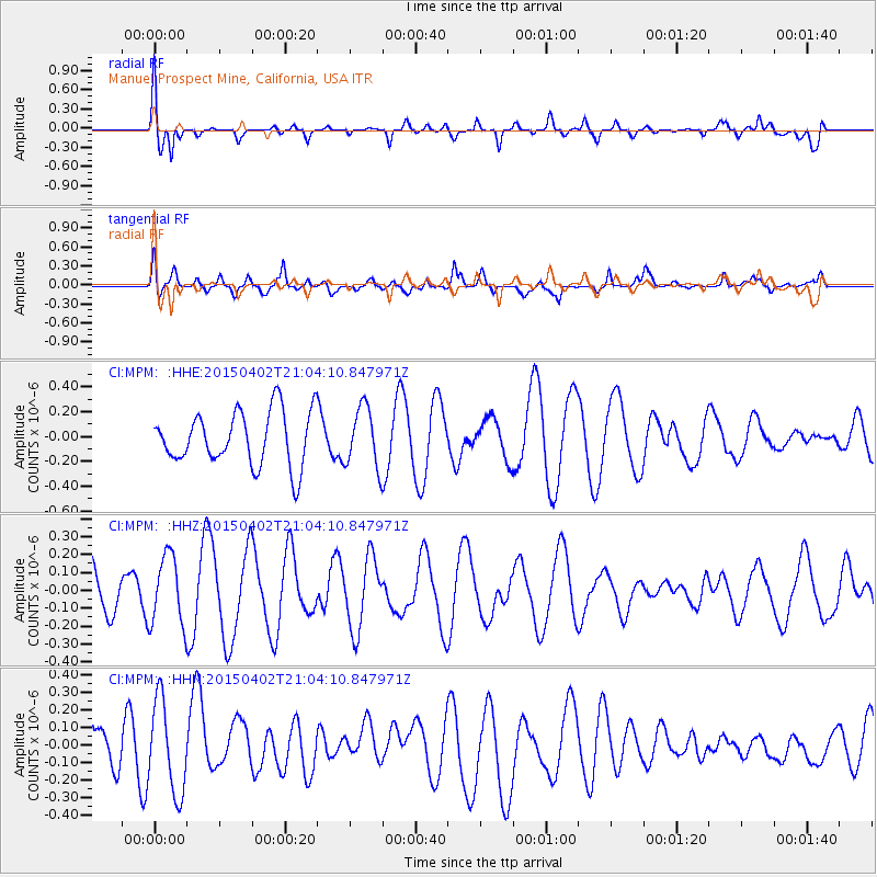
MPM Manuel Prospect Mine, California, USA - Earthquake Result Viewer
*The percent match for this event was below the threshold and hence no stack was calculated.
| Earthquake location: |
Eastern New Guinea Reg., P.N.G. |
| Earthquake latitude/longitude: |
-6.4/147.0 |
| Earthquake time(UTC): |
2015/04/02 (092) 20:51:07 GMT |
| Earthquake Depth: |
26 km |
| Earthquake Magnitude: |
5.2 MW |
| Earthquake Catalog/Contributor: |
ISC/ISC |
|
| Network: |
CI Caltech Regional Seismic Network |
| Station: |
MPM Manuel Prospect Mine, California, USA |
| Lat/Lon: |
36.06 N/117.49 W |
| Elevation: |
185 m |
|
| Distance: |
98.2 deg |
| Az: |
54.572 deg |
| Baz: |
268.029 deg |
| Ray Param: |
$rayparam |
*The percent match for this event was below the threshold and hence was not used in the summary stack. |
|
| Radial Match: |
54.057156 % |
| Radial Bump: |
400 |
| Transverse Match: |
55.923004 % |
| Transverse Bump: |
400 |
| SOD ConfigId: |
7422571 |
| Insert Time: |
2019-04-18 01:27:41.994 +0000 |
| GWidth: |
2.5 |
| Max Bumps: |
400 |
| Tol: |
0.001 |
|
Signal To Noise
| Channel | StoN | STA | LTA |
| CI:MPM: :HHZ:20150402T21:04:10.847971Z | 0.940328 | 1.9343618E-7 | 2.0571139E-7 |
| CI:MPM: :HHN:20150402T21:04:10.847971Z | 1.6922642 | 2.6171696E-7 | 1.546549E-7 |
| CI:MPM: :HHE:20150402T21:04:10.847971Z | 1.1204462 | 2.4160835E-7 | 2.1563582E-7 |
| Arrivals |
| Ps | |
| PpPs | |
| PsPs/PpSs | |


