You are here: Home > Network List > CN - Canadian National Seismograph Network Stations List
> Station SADO SADOWA, ON > Earthquake Result Viewer
SADO SADOWA, ON - Earthquake Result Viewer

| Earthquake location: |
Kuril Islands |
| Earthquake latitude/longitude: |
44.6/148.7 |
| Earthquake time(UTC): |
2014/07/20 (201) 18:32:47 GMT |
| Earthquake Depth: |
61 km |
| Earthquake Magnitude: |
6.6 MB |
| Earthquake Catalog/Contributor: |
NEIC PDE/NEIC COMCAT |
|
| Network: |
CN Canadian National Seismograph Network |
| Station: |
SADO SADOWA, ON |
| Lat/Lon: |
44.77 N/79.14 W |
| Elevation: |
243 m |
|
| Distance: |
81.4 deg |
| Az: |
32.298 deg |
| Baz: |
327.613 deg |
| Ray Param: |
0.04752089 |
| Estimated Moho Depth: |
36.75 km |
| Estimated Crust Vp/Vs: |
1.88 |
| Assumed Crust Vp: |
6.577 km/s |
| Estimated Crust Vs: |
3.498 km/s |
| Estimated Crust Poisson's Ratio: |
0.30 |
|
| Radial Match: |
93.58794 % |
| Radial Bump: |
369 |
| Transverse Match: |
84.66423 % |
| Transverse Bump: |
400 |
| SOD ConfigId: |
751272 |
| Insert Time: |
2014-08-03 18:59:33.741 +0000 |
| GWidth: |
2.5 |
| Max Bumps: |
400 |
| Tol: |
0.001 |
|
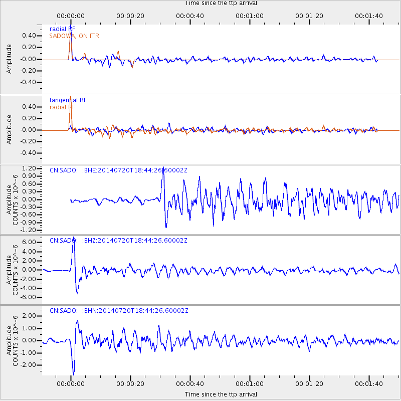
Signal To Noise
| Channel | StoN | STA | LTA |
| CN:SADO: :BHZ:20140720T18:44:26.60002Z | 26.737942 | 3.1842658E-6 | 1.1909165E-7 |
| CN:SADO: :BHN:20140720T18:44:26.60002Z | 13.975046 | 1.2135391E-6 | 8.6836145E-8 |
| CN:SADO: :BHE:20140720T18:44:26.60002Z | 8.0982275 | 5.6290514E-7 | 6.9509674E-8 |
| Arrivals |
| Ps | 5.1 SECOND |
| PpPs | 16 SECOND |
| PsPs/PpSs | 21 SECOND |


