You are here: Home > Network List > UW - Pacific Northwest Regional Seismic Network Stations List
> Station PASS Maple Falls, WA, USA > Earthquake Result Viewer
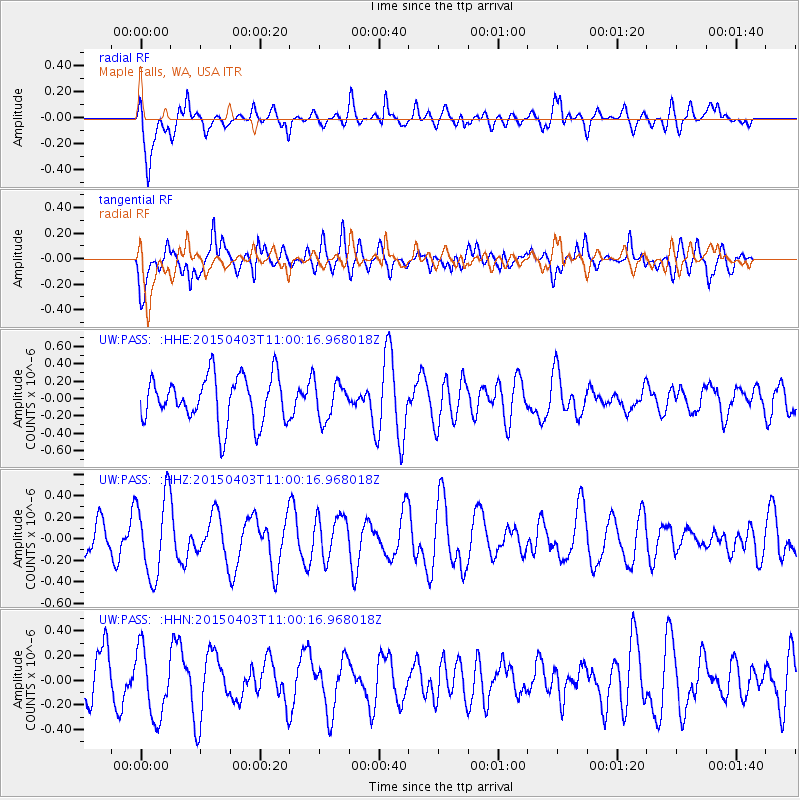
PASS Maple Falls, WA, USA - Earthquake Result Viewer
*The percent match for this event was below the threshold and hence no stack was calculated.
| Earthquake location: |
New Britain Region, P.N.G. |
| Earthquake latitude/longitude: |
-5.6/153.0 |
| Earthquake time(UTC): |
2015/04/03 (093) 10:47:48 GMT |
| Earthquake Depth: |
37 km |
| Earthquake Magnitude: |
4.8 mb |
| Earthquake Catalog/Contributor: |
ISC/ISC |
|
| Network: |
UW Pacific Northwest Regional Seismic Network |
| Station: |
PASS Maple Falls, WA, USA |
| Lat/Lon: |
49.00 N/122.09 W |
| Elevation: |
174 m |
|
| Distance: |
90.8 deg |
| Az: |
41.001 deg |
| Baz: |
262.54 deg |
| Ray Param: |
$rayparam |
*The percent match for this event was below the threshold and hence was not used in the summary stack. |
|
| Radial Match: |
42.741207 % |
| Radial Bump: |
388 |
| Transverse Match: |
56.357143 % |
| Transverse Bump: |
400 |
| SOD ConfigId: |
7422571 |
| Insert Time: |
2019-04-18 01:51:36.959 +0000 |
| GWidth: |
2.5 |
| Max Bumps: |
400 |
| Tol: |
0.001 |
|
Signal To Noise
| Channel | StoN | STA | LTA |
| UW:PASS: :HHZ:20150403T11:00:16.968018Z | 2.1390233 | 3.715312E-7 | 1.7369199E-7 |
| UW:PASS: :HHN:20150403T11:00:16.968018Z | 1.4708885 | 2.8069474E-7 | 1.9083346E-7 |
| UW:PASS: :HHE:20150403T11:00:16.968018Z | 0.7895652 | 2.1184378E-7 | 2.6830435E-7 |
| Arrivals |
| Ps | |
| PpPs | |
| PsPs/PpSs | |


