You are here: Home > Network List > IU - Global Seismograph Network (GSN - IRIS/USGS) Stations List
> Station PMG Port Moresby, New Guinea > Earthquake Result Viewer
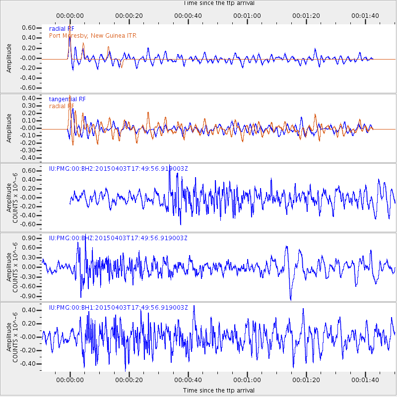
PMG Port Moresby, New Guinea - Earthquake Result Viewer
*The percent match for this event was below the threshold and hence no stack was calculated.
| Earthquake location: |
Fiji Islands Region |
| Earthquake latitude/longitude: |
-17.4/-177.0 |
| Earthquake time(UTC): |
2015/04/03 (093) 17:44:02 GMT |
| Earthquake Depth: |
379 km |
| Earthquake Magnitude: |
5.8 MW |
| Earthquake Catalog/Contributor: |
ISC/ISC |
|
| Network: |
IU Global Seismograph Network (GSN - IRIS/USGS) |
| Station: |
PMG Port Moresby, New Guinea |
| Lat/Lon: |
9.40 S/147.16 E |
| Elevation: |
90 m |
|
| Distance: |
35.7 deg |
| Az: |
278.115 deg |
| Baz: |
106.658 deg |
| Ray Param: |
$rayparam |
*The percent match for this event was below the threshold and hence was not used in the summary stack. |
|
| Radial Match: |
62.67012 % |
| Radial Bump: |
400 |
| Transverse Match: |
55.062767 % |
| Transverse Bump: |
400 |
| SOD ConfigId: |
7422571 |
| Insert Time: |
2019-04-18 02:00:29.937 +0000 |
| GWidth: |
2.5 |
| Max Bumps: |
400 |
| Tol: |
0.001 |
|
Signal To Noise
| Channel | StoN | STA | LTA |
| IU:PMG:00:BHZ:20150403T17:49:56.919003Z | 2.87769 | 3.589059E-7 | 1.2472015E-7 |
| IU:PMG:00:BH1:20150403T17:49:56.919003Z | 1.8416537 | 1.5229753E-7 | 8.2696076E-8 |
| IU:PMG:00:BH2:20150403T17:49:56.919003Z | 2.0675993 | 2.1172349E-7 | 1.02400634E-7 |
| Arrivals |
| Ps | |
| PpPs | |
| PsPs/PpSs | |


