You are here: Home > Network List > US - United States National Seismic Network Stations List
> Station MSO Missoula, Montana, USA > Earthquake Result Viewer
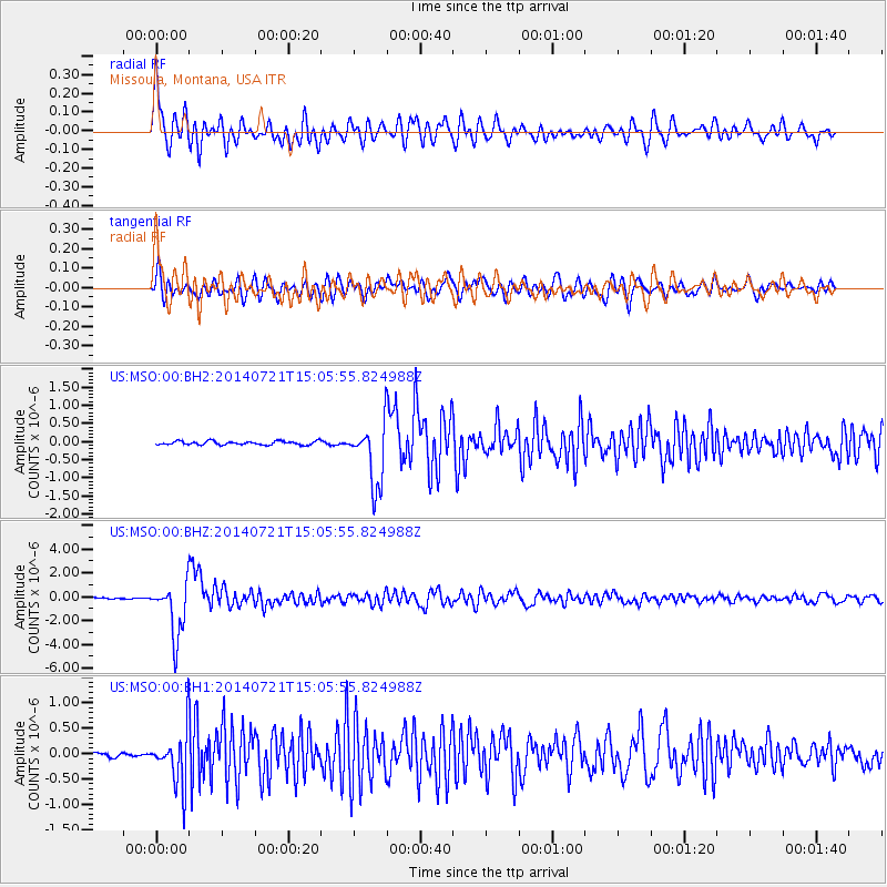
MSO Missoula, Montana, USA - Earthquake Result Viewer
*The percent match for this event was below the threshold and hence no stack was calculated.
| Earthquake location: |
Fiji Islands Region |
| Earthquake latitude/longitude: |
-19.8/-178.4 |
| Earthquake time(UTC): |
2014/07/21 (202) 14:54:40 GMT |
| Earthquake Depth: |
616 km |
| Earthquake Magnitude: |
6.9 MWB, 6.9 MI |
| Earthquake Catalog/Contributor: |
NEIC PDE/NEIC ALERT |
|
| Network: |
US United States National Seismic Network |
| Station: |
MSO Missoula, Montana, USA |
| Lat/Lon: |
46.83 N/113.94 W |
| Elevation: |
1264 m |
|
| Distance: |
88.1 deg |
| Az: |
38.322 deg |
| Baz: |
238.263 deg |
| Ray Param: |
$rayparam |
*The percent match for this event was below the threshold and hence was not used in the summary stack. |
|
| Radial Match: |
75.58108 % |
| Radial Bump: |
400 |
| Transverse Match: |
77.178345 % |
| Transverse Bump: |
400 |
| SOD ConfigId: |
751272 |
| Insert Time: |
2014-08-04 15:46:28.118 +0000 |
| GWidth: |
2.5 |
| Max Bumps: |
400 |
| Tol: |
0.001 |
|
Signal To Noise
| Channel | StoN | STA | LTA |
| US:MSO:00:BHZ:20140721T15:05:55.824988Z | 43.308556 | 2.2524202E-6 | 5.2008666E-8 |
| US:MSO:00:BH1:20140721T15:05:55.824988Z | 10.6118965 | 5.180936E-7 | 4.8821963E-8 |
| US:MSO:00:BH2:20140721T15:05:55.824988Z | 16.68471 | 8.5552057E-7 | 5.1275727E-8 |
| Arrivals |
| Ps | |
| PpPs | |
| PsPs/PpSs | |


