You are here: Home > Network List > UW - Pacific Northwest Regional Seismic Network Stations List
> Station LEBA Lebam, WA, USA > Earthquake Result Viewer
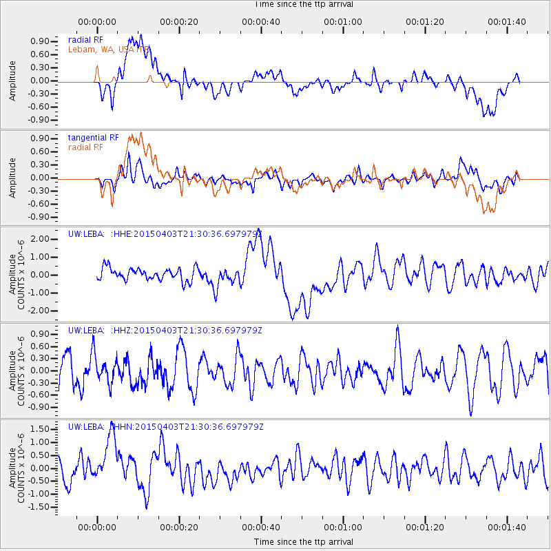
LEBA Lebam, WA, USA - Earthquake Result Viewer
*The percent match for this event was below the threshold and hence no stack was calculated.
| Earthquake location: |
Eastern New Guinea Reg., P.N.G. |
| Earthquake latitude/longitude: |
-6.3/147.8 |
| Earthquake time(UTC): |
2015/04/03 (093) 21:17:54 GMT |
| Earthquake Depth: |
30 km |
| Earthquake Magnitude: |
5.9 MWW, 5.8 MWB, 5.9 MWC |
| Earthquake Catalog/Contributor: |
NEIC PDE/NEIC COMCAT |
|
| Network: |
UW Pacific Northwest Regional Seismic Network |
| Station: |
LEBA Lebam, WA, USA |
| Lat/Lon: |
46.55 N/123.56 W |
| Elevation: |
73 m |
|
| Distance: |
93.6 deg |
| Az: |
43.741 deg |
| Baz: |
264.73 deg |
| Ray Param: |
$rayparam |
*The percent match for this event was below the threshold and hence was not used in the summary stack. |
|
| Radial Match: |
44.1541 % |
| Radial Bump: |
400 |
| Transverse Match: |
39.090565 % |
| Transverse Bump: |
400 |
| SOD ConfigId: |
7422571 |
| Insert Time: |
2019-04-18 02:16:59.189 +0000 |
| GWidth: |
2.5 |
| Max Bumps: |
400 |
| Tol: |
0.001 |
|
Signal To Noise
| Channel | StoN | STA | LTA |
| UW:LEBA: :HHZ:20150403T21:30:36.697979Z | 0.6807457 | 3.2648788E-7 | 4.7960333E-7 |
| UW:LEBA: :HHN:20150403T21:30:36.697979Z | 2.1321104 | 1.0439187E-6 | 4.896176E-7 |
| UW:LEBA: :HHE:20150403T21:30:36.697979Z | 1.4544555 | 5.018583E-7 | 3.4504893E-7 |
| Arrivals |
| Ps | |
| PpPs | |
| PsPs/PpSs | |


