You are here: Home > Network List > AV - Alaska Volcano Observatory Stations List
> Station MAPS Pakushin Southeast, Makushin Volcano, Alaska > Earthquake Result Viewer
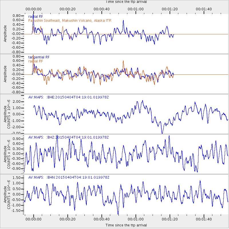
MAPS Pakushin Southeast, Makushin Volcano, Alaska - Earthquake Result Viewer
*The percent match for this event was below the threshold and hence no stack was calculated.
| Earthquake location: |
New Britain Region, P.N.G. |
| Earthquake latitude/longitude: |
-5.4/152.9 |
| Earthquake time(UTC): |
2015/04/04 (094) 04:08:35 GMT |
| Earthquake Depth: |
22 km |
| Earthquake Magnitude: |
5.3 MW |
| Earthquake Catalog/Contributor: |
ISC/ISC |
|
| Network: |
AV Alaska Volcano Observatory |
| Station: |
MAPS Pakushin Southeast, Makushin Volcano, Alaska |
| Lat/Lon: |
53.81 N/166.94 W |
| Elevation: |
333 m |
|
| Distance: |
67.9 deg |
| Az: |
24.386 deg |
| Baz: |
223.879 deg |
| Ray Param: |
$rayparam |
*The percent match for this event was below the threshold and hence was not used in the summary stack. |
|
| Radial Match: |
59.52623 % |
| Radial Bump: |
375 |
| Transverse Match: |
67.25995 % |
| Transverse Bump: |
336 |
| SOD ConfigId: |
7422571 |
| Insert Time: |
2019-04-18 02:18:53.798 +0000 |
| GWidth: |
2.5 |
| Max Bumps: |
400 |
| Tol: |
0.001 |
|
Signal To Noise
| Channel | StoN | STA | LTA |
| AV:MAPS: :BHZ:20150404T04:19:01.019978Z | 1.0859466 | 5.7877753E-7 | 5.3297055E-7 |
| AV:MAPS: :BHN:20150404T04:19:01.019978Z | 1.3658047 | 4.6312158E-7 | 3.390833E-7 |
| AV:MAPS: :BHE:20150404T04:19:01.019978Z | 0.88691807 | 5.657838E-7 | 6.379212E-7 |
| Arrivals |
| Ps | |
| PpPs | |
| PsPs/PpSs | |


