You are here: Home > Network List > TA - USArray Transportable Network (new EarthScope stations) Stations List
> Station J01E Myrtle Point, OR, USA > Earthquake Result Viewer
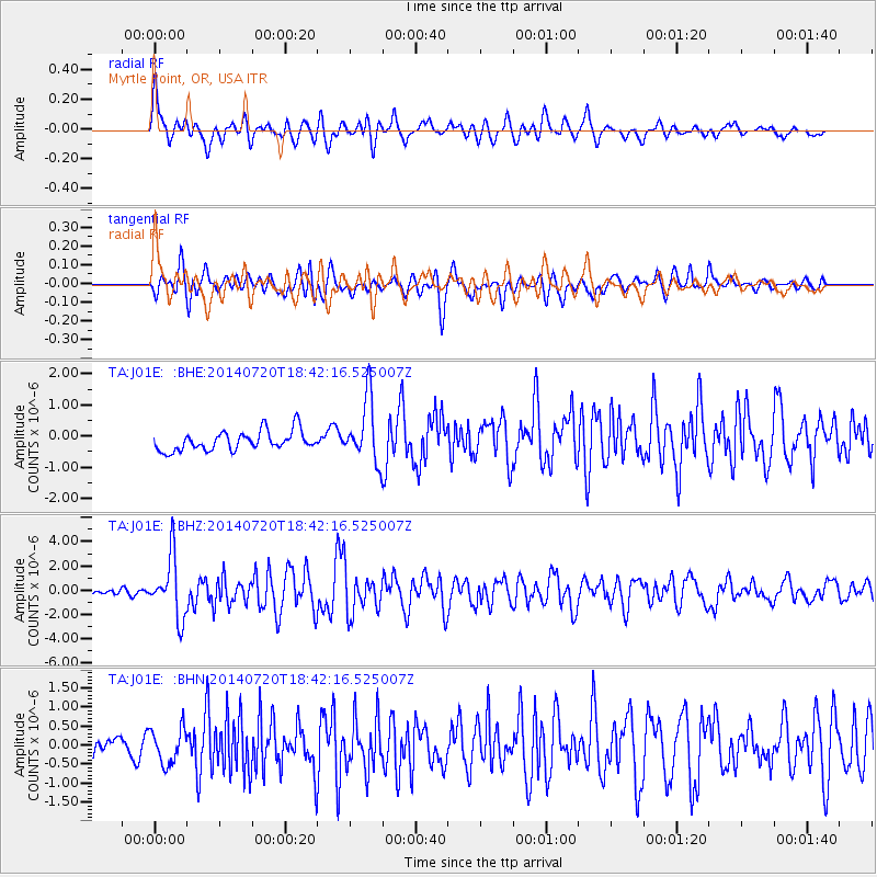
J01E Myrtle Point, OR, USA - Earthquake Result Viewer
*The percent match for this event was below the threshold and hence no stack was calculated.
| Earthquake location: |
Kuril Islands |
| Earthquake latitude/longitude: |
44.6/148.7 |
| Earthquake time(UTC): |
2014/07/20 (201) 18:32:47 GMT |
| Earthquake Depth: |
61 km |
| Earthquake Magnitude: |
6.6 MB |
| Earthquake Catalog/Contributor: |
NEIC PDE/NEIC COMCAT |
|
| Network: |
TA USArray Transportable Network (new EarthScope stations) |
| Station: |
J01E Myrtle Point, OR, USA |
| Lat/Lon: |
43.16 N/123.93 W |
| Elevation: |
128 m |
|
| Distance: |
59.9 deg |
| Az: |
57.651 deg |
| Baz: |
304.469 deg |
| Ray Param: |
$rayparam |
*The percent match for this event was below the threshold and hence was not used in the summary stack. |
|
| Radial Match: |
73.97286 % |
| Radial Bump: |
400 |
| Transverse Match: |
73.86181 % |
| Transverse Bump: |
400 |
| SOD ConfigId: |
751272 |
| Insert Time: |
2014-08-04 16:13:48.214 +0000 |
| GWidth: |
2.5 |
| Max Bumps: |
400 |
| Tol: |
0.001 |
|
Signal To Noise
| Channel | StoN | STA | LTA |
| TA:J01E: :BHZ:20140720T18:42:16.525007Z | 6.0611567 | 2.4766439E-6 | 4.086091E-7 |
| TA:J01E: :BHN:20140720T18:42:16.525007Z | 1.7958763 | 4.602181E-7 | 2.562638E-7 |
| TA:J01E: :BHE:20140720T18:42:16.525007Z | 3.2514246 | 1.011723E-6 | 3.11163E-7 |
| Arrivals |
| Ps | |
| PpPs | |
| PsPs/PpSs | |


